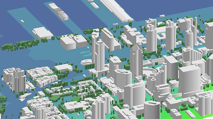
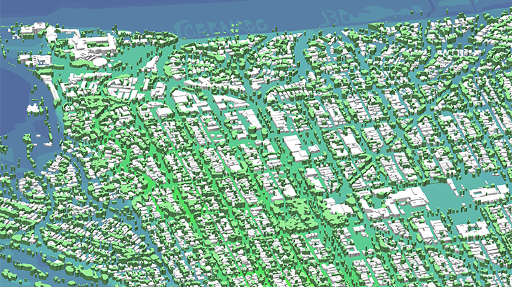
3D Model of San Diego harbor area Geodata includes 3D buildings with slope roofs and very detailed roof elements, as well as 3D Trees with individual heights. The 3D Model was produced for the massive MIMO mm-wave network planning and advanced 3D simulation in urban environments.
Covered area – 50 sq.km
Can be delivered in any format:
✅ RF-tools: Atoll, Asset, Planet, ISC Telecom, Pathloss, Nokia NetAct, NetPlan …
✅ GIS: shp, dwg, obj, rhino, skp, CAD, ESRI ArcGIS
5G supports higher mobile data rates and Internet of Things (IoT) connectivity that will revolutionize all interactions in our life. 5G enhances 4G LTE capabilities for new IoT applications and creates new opportunities to improve business efficiency. 5G presents exciting possibilities for mobile like cars and vehicles connection, augmented and virtual reality, healthcare monitoring etc.
Therefore, all operators need smart planning to open new prospects provided by 5G technologies.
3D Geodata are basic and keystone for 5G planning. We understand the precise geodata requirements to design next-generation networks in mmWave frequencies range. Based on our 19-years experience, we offer the most cost-effective solution for any territory fitted to your budget. Please visit our webpage "Pilot Projects for 5G Planning over the World".
Download the free data sample of 3D digital models
Send us request for more information

