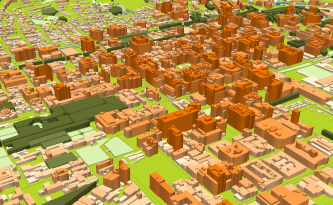
Project for Radio Frequency planning, Geoinformation System and WEB-applications that covers:
Ethiopia models:
- 3D map of Addis-Ababa – 534 sq km and 2D map of Addis-Abeba – 542 sq km
- 3D map of Debub Mirab Shewa – 96 sq km and 2D map of Debub Mirab Shewa – 6594 sq km
- 3D map of Mirab Shewa – 32 sq km and 2D map of Mirab Shewa – 15340 sq km
- 3D map of Misraq Shewa – 37 sq km and 2D map of Misraq Shewa – 10062 sq km
- 3D map of North Shewa – 84 sq km and 2D map of North Shewa – 11293 sq km
- 3D map of Bahirdar (Mirab Gojjam) – 140 sq km and 2D map of Bahirdar – 16490 sq km
- 3D map of Dire Dawa – 40 sq km and 2D map of Dire Dawa – 1058 sq km
- 3D map of Gondar – 39 sq km and 2D map of Gondar – 43148 sq km
- 3D map of Mekele – 107 sq km and 2D map of Mekele – 10186 sq km
- 3D map of Adama – 61 sq km
- 3D map of Asosa – 10 sq km
- 3D map of Awassa – 50 sq km
- 3D map of Gambela – 16 sq km
- 3D map of Harar – 24 sq km
- 3D map of Jijiga – 32 sq km
- 3D map of Semera – 7 sq km
and SAR (South African Republic) models:
- 3D map of Cape Town – 11 sq km and 2D map of Cape Town – 2457 sq km
- 3D map of Durban – 14 sq km and 2D map of Durban – 2286 sq km
- 2D map of Johannesburg – 1648 sq km and 2D map of Pretoria – 6310 sq km
- 2D map of Port Elizabeth – 1958 sq km
Please download the free data samples of the Ethiopia and SAR projects.


