News & Events
2D MODELS AND MAPS OF GEORGIAN CITY AND GEORGIA
[2D Urban Model][2] of Kutaisi – 160 sq km
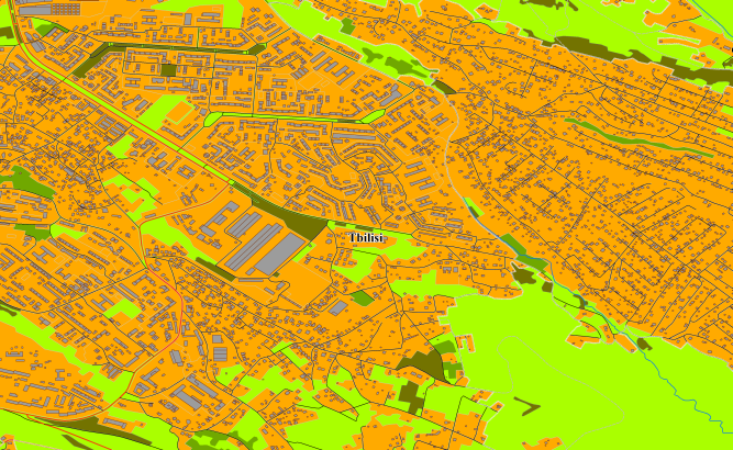
[2D Urban Model][3] Tbilisi and [2D Urban Model][4] of Rustavi – 750 sq km
[Countrywide 2D Regional Model][5] of Georgia – 73750 sq km
**data for GIS project and WEB project:** [Map][6] of Batumi – 115 sq km
[Map][7] of Kutaisi – 160 sq km
[Map][8] of Tbilisi and map of Rustavi – 750 sq km
[Countrywide map][9] of Georgia (Georgia Country map) – 73750 sq km
[See our maps to view online map of Georgia][10] and [online map of Tbilisi][11] [online map of Batumi][12] [online map of Kutaisi][13] Project package includes 3 types of data representation:
1. Vector data model provided as a composition of vector layers in ESRI ArcGIS or Mapinfo formats.
2. Raster data model presented in Geo-tif format and includes:
• Digital Elevation Model (DEM) (data placed in Height.tif file);
• Land Use Map (Clutter Model)
3. Service Data for RF planning tools:
• [Digital Terrain Model (DTM][14]);
• Land Use Map (Clutter Model) in matrix representation;
• Text labels;
• Vector layers.
Resolution of 2D model(cell size of matrix): 5m and 20 m
[1]: https://visicomdata.com/products/data_for_wireless_planning/2d_urban_models?lang=en [2]: https://visicomdata.com/products/data_for_wireless_planning/2d_urban_models?lang=en [3]: https://visicomdata.com/products/data_for_wireless_planning/2d_urban_models?lang=en [4]: https://visicomdata.com/products/data_for_wireless_planning/2d_urban_models?lang=en [5]: https://visicomdata.com/products/data_for_wireless_planning/regional_models?lang=en [6]: https://visicomdata.com/products/geospatial_data?lang=en [7]: https://visicomdata.com/products/geospatial_data?lang=en [8]: https://visicomdata.com/products/geospatial_data?lang=en [9]: https://visicomdata.com/products/geospatial_data?lang=en [10]: https://maps.visicom.ua/c/42.82471,42.43562,8/f/ADMGE?lang=en [11]: https://maps.visicom.ua/c/44.80328,41.74007,12/f/STL1OSCV5?lang=en [12]: https://maps.visicom.ua/c/41.64318,41.64222,13/f/STL1OT00H?lang=en [13]: https://maps.visicom.ua/c/42.64412,42.27756,12/f/STL1OUPQP?lang=en [14]: https://visicomdata.com/products/elevation_products?lang=en


Order product
Please, contact us directly if you have question
We always reply within 24 hours
Contact us
Please, contact us directly if you need any information