Implementation of artificial intelligence for recognizing and extracting 3D building footprints from satellite images
Innovations in Satellite Image Processing
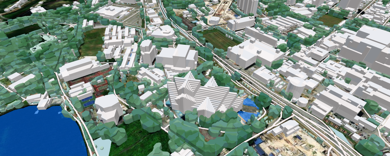
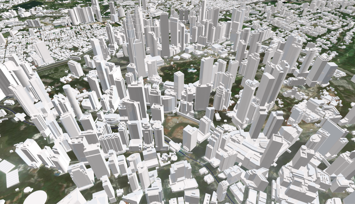
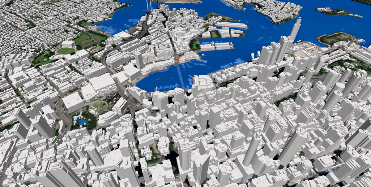
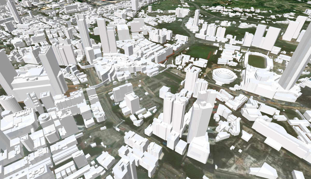
VISICOM has developed and implemented an AI-based technology for recognizing current satellite images with a resolution of 0.3-0.5 meters, allowing for the automatic creation of three-dimensional building maps nationally.
Over the past few years, we have created 3D coverage for 17 countries using a machine learning (ML) algorithm, encompassing approximately 150 million buildings.
3D models are currently available for the following countries: UAE, Qatar, Kuwait, Bahrain, Turkey, Croatia, Montenegro, Romania, the Czech Republic, Greece, Slovakia, Mexico, Taiwan, Austria, Macedonia, Vietnam, and Thailand.
Our research and development teams combine our GIS expertise with advances in artificial intelligence. This combination provides a tool for easily, quickly, and cost-effectively creating 3D models of large areas anywhere on Earth.
Implementation and markets
3D buildings can be used in various industries, including telecommunications, geomarketing, WEB/GIS applications, urban and cadastral planning, military, environmental protection, and communal services.
3D data creates a full digital analog of the country together with other geodata layers in maps for regional planning:
- Street and road network
- Railways
- 3D bridges
- Terrain relief
- Hydrography
- Land use
- Population density distribution
Advantages of using AI algorithms:
- Automation of production and, accordingly, reduction of project implementation time: 99% of buildings with an area of > 25 sq m are automatically recognized using a machine learning algorithm
- Completeness: 100% coverage of building contours is achieved through post-processing and validation
- Plan and height accuracy: +/- 3 m
Stages of production:
- Creation of building standards: The references include the most common building types. For each region with a relevant building type, its reference database and input parameters with accurate coefficients that work well for similar terrain should be used.
- The stage of artificial intelligence and machine learning:
- Application of threshold coefficients for building layer identification
- Recognizing building patterns using deep learning algorithms
- Creating a raster by a neural network
- Calibrating and changing the input parameters of the neural network (changing coefficients, color patterns, geometric patterns, adding new benchmarks to the database).
- The cycle can be repeated several times from the beginning to achieve the desired planimetric accuracy of 3 m CE90.
- Creating vector contours of a building from a raster
- Adding elevation values to building contours
- Post-processing: Final check, correction and verification of the building dataset, geometry and elevations.
- Integration into the final product: for example, creation of a full 3D country model, generation of DHM/Clutter Heights, used to create a detailed population map.
The usage of 3D maps offers a number of advantages for planning processes in any industry on a national scale.
For example, mobile network planning ensures optimal coverage of the country.
A comprehensive view of buildings improves strategic planning of the country's territorial and infrastructure development. The data produced simultaneously for the whole country has unified technical characteristics, simplifying any project's coordination.
Our technologies allow us to customize production processes to meet customer requirements and offer flexible delivery schedules and comfortable prices.
We always provide free data for testing and agreeing on technical specifications. All types of models, not only 3D, for many countries can be downloaded directly from our website.

