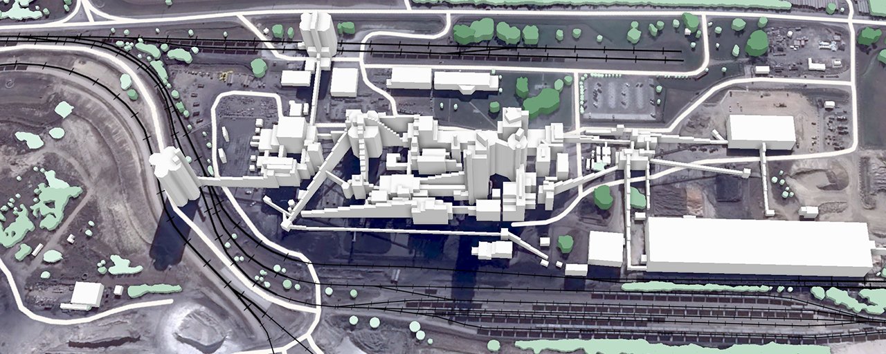
Imagine a large industrial complex: production buildings, warehouses, internal roads, pipelines, technical facilities, loading areas and dozens of other structures. Industrial sites also increasingly rely on connected equipment, cameras, sensors, automated vehicles and digital management systems.
An engineer planning a new communication network, automation systems or an infrastructure upgrade needs accurate digital information about where all these objects are located. A standard map is not enough: the task requires a digital model of the site.
What can a 3D map of an industrial site show?
3D geodata adds what a flat map lacks: the height and shape of objects.
For some tasks, building geometry and heights are enough. Others require more detailed structures, passages, engineering facilities or specific attributes. A 3D model of an industrial site therefore does not need the highest possible level of detail. It needs the level of detail that matches the task it is created for.
Private 5G at a car plant: when geodata becomes part of industrial infrastructure
In 2025, Ericsson announced the deployment of a private 5G network at JLR's plant in Solihull, UK. The network supports vision systems, IoT sensors and production tools, and creates opportunities for further automation.
To plan reliable wireless coverage across such a site, engineers need to consider its physical features. Tall buildings, metal structures, storage tanks and other objects affect how radio signals propagate. This is where 3D geodata becomes one of the inputs for radio network planning.
The question is no longer only whether there is a signal across the factory site. What matters is whether the network can reliably support the equipment and services it was designed for.
Steel plants: sites that look like small cities
Steel plants are another example. Their sites can cover enormous areas, with production buildings, blast furnaces, steelmaking and rolling equipment, tall chimneys, storage tanks, conveyors, railway tracks, complex metal structures and many supporting facilities.
For such sites, it is important to consider not only where buildings are located, but also the height and geometry of industrial structures. This is especially important when planning wireless networks.
RF planning and infrastructure management: the same 3D model?
Not necessarily.
- For RF planning, the geometry, height, materials and location of objects that affect radio signals may be important.
- For infrastructure management, the focus may be on identifying objects, their attributes and the connections between them.
That is why creating 3D data for an industrial site should start with a simple question: what exactly will the data be used for?
In the past, a map of an industrial site mainly helped people see what was located where. Today, it can serve as a basis for a much wider range of technical tasks.
3D geodata for industrial sites by VISICOM
VISICOM has experience in creating 3D geodata for industrial sites. Industrial 3D modelling requires a specific approach: it is important to consider not only the size of the site, but also the complexity of its structures and the infrastructure located there.
Download free samples of 3D maps of industrial sites and test them:

