Initially, only 2D maps were used in geographic information systems (GIS) around the 1970s and 1980s. These 2D maps represented the Earth's surface as flat images without considering elevation. By the 1990s, with the development of digital mapping technologies, it became possible to integrate height data into 2D maps. This allowed for the creation of more accurate models, particularly through the use of Digital Terrain Models (DTM), where heights were represented as isolated lines or flat surfaces, rather than fully three-dimensional models.
In the 2000s, the advancement of satellite technology and laser scanning, such as LiDAR (Light Detection and Ranging), made it possible to create more accurate maps of terrain, where the heights of specific objects, such as buildings, trees, and bridges, could be considered. This marked the first step in creating 2.5D maps, which included additional height information.
Why Are 2.5D Maps Important?
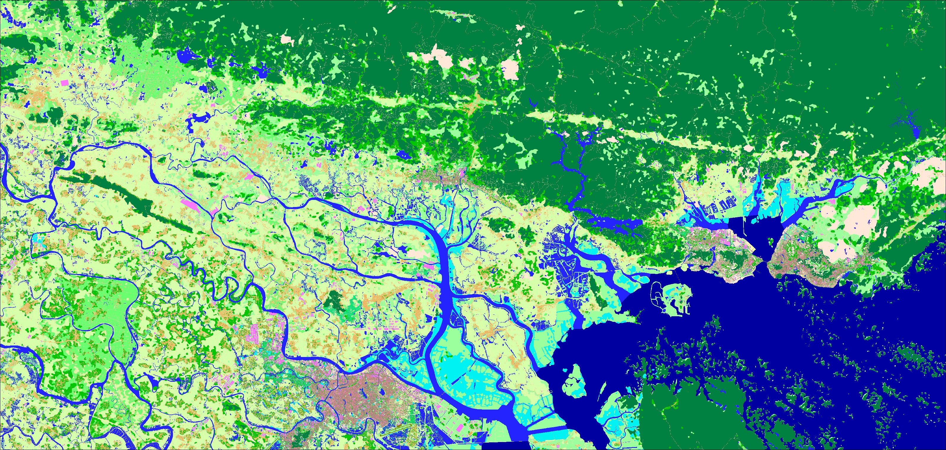
Compared to traditional 2D maps, 2.5D maps allow for better modeling of situations where elevation needs to be considered, such as for analyzing line-of-sight communication, weather prediction, water resource dynamics, or, in modern contexts, for 5G networks, where obstacles like buildings, forests, and hills must be factored in.
Currently, 3D maps play a leading role in 5G network planning. However, there are still cases where lower-resolution 2D and 2.5D maps (e.g., with grid cell sizes of 5m and 10m) play an essential role in the planning process. Here's why these maps are still valuable:
- Initial Planning and Macro Analysis – In the early stages of network deployment, using larger grid cells provides a general overview of coverage, population density, and geographic features. This approach is less labor-intensive and helps identify priority areas for more detailed analysis using high-precision 3D maps.
- Faster Modeling – Due to their larger grid size, 2D and 2.5D maps enable faster simulations, particularly in early planning stages. This is crucial when covering large areas efficiently.
- Cost-Effectiveness – In some cases, using lower-resolution 2D and 2.5D maps is more cost-effective than generating high-resolution 3D maps for an entire coverage area. Planners can balance the need for detailed data with budget constraints by strategically using a mix of 3D, 2D, and 2.5D maps at different stages of the planning process.
Are There Cases Where 3D Models Alone Are Not Enough for 5G Network Planning?
Yes, there are several scenarios where 3D models alone are insufficient:
- Large-Scale Coverage Estimations – When planning coverage for an entire country or region, using high-resolution 3D models for the whole area can be computationally expensive and impractical. Instead, 2D or 2.5D maps with lower resolution (e.g., 10m grid) provide an efficient way to estimate coverage.
- Early-Stage Network Planning – Before detailed site selection begins, operators use lower-resolution maps to conduct feasibility studies, analyze demand, and estimate spectrum needs. These initial assessments help prioritize regions for more in-depth 3D analysis.
- Cost and Computational Constraints – While 3D models provide high accuracy, they require significant computational resources. In cases where budget or processing power is limited, a hybrid approach using 2D and 2.5D models can balance cost and accuracy.
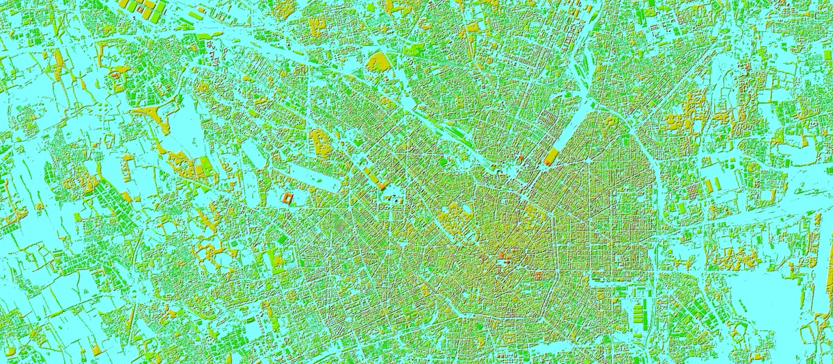
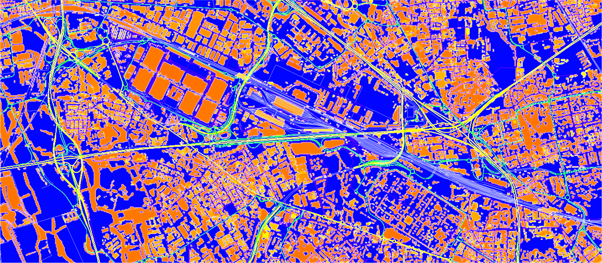
- Integration with Existing GIS Data – Many network planning tools rely on 2D geospatial datasets, such as population density maps, road networks, and administrative boundaries. Combining these with 3D models is necessary for a comprehensive planning approach.
- Long-Term Infrastructure Planning – Some infrastructure projects, such as fiber-optic deployment or small cell placements, require data best represented in 2D or 2.5D models, such as street-level obstructions or zoning restrictions, rather than full 3D city models.
Real-World Examples of 2.5D Map Use
For example, when planning 5G deployment in mountainous regions like Switzerland or Italy, operators faced challenges due to rugged terrain. While 3D models provided high accuracy, they were computationally intensive and costly. Planners first used 2D and 2.5D maps for quick terrain assessments, identifying the best areas for base station placement. Once the feasibility study was complete, 3D models were introduced for refined urban deployment. This hybrid approach reduced costs and optimized network performance.
In densely populated cities, network planners struggled with signal blockage from high-rise buildings. Instead of immediately using expensive 3D models, they first analyzed 2.5D maps to assess major obstructions and estimate line-of-sight coverage. This initial step streamlined network rollout, reduced redundant infrastructure investments and allowed for a more targeted approach when integrating high-resolution 3D data.
So, we summarize that while 3D maps are essential for precise network design, 2D and 2.5D maps remain indispensable tools for large-scale planning and early-stage feasibility studies. Real-world applications in both urban and mountainous environments highlight the efficiency of a hybrid mapping approach. By strategically combining different mapping techniques, planners can achieve optimal 5G coverage, minimal interference, and cost-effective deployment.
We understand the specific needs of each country in diverse regions and have data that precisely meets those needs.
Contact us for free data samples or trials.
Learn more about our REGIONAL MAPS for 5G planning here

