Radio Frequency (Rf) Maps Of Tanzania Cities For Cellular Networks Planning
🔔 We would like to propose accurate 2,5D and 3D maps for the network planning phase for a reasonable level of prices.
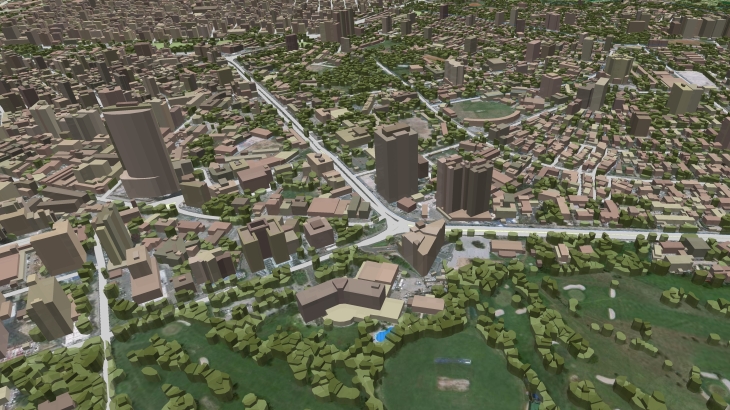
Visicom ® produces high-level geodata for 5G planning because we have 20 years of experience to cooperate with telcos and operators worldwide.
That is why you can be sure of the quality of our products.
We have 3D buildings and vegetation models for 5G network planning which are fully optimized for use with Millimeter Wave (mmWave) frequencies and can be used in different tools like Atoll, Asset, Planet, ICS, etc.
CITY MODELS:
- ✅ 3D RF map of Dar es Salaam – 217 sq.km
- ✅ 2.5D RF map of Dar es Salaam – 1403 sq.km
- ✅ 3D RF map of Dodoma – 26 sq.km
- ✅ 2.5D RF map of Dodoma, 5m – 369 sq.km
More cities will be available soon.
Content of city models:**
- DTM
- Land Use/Clutter Model
- Clutter Heights Model
- 2D building layer with an indication of the height
- Basic vector layers: roads, streets, water lines, etc.

