Always supporting the Ukrainian Telecom market from 2G to 5G networks deployment, we permanently update and upgrade our 2D and 3D data for all of Ukraine.
For now, high-quality 2D and 3D maps for regional, urban, and city planning include:
- Settlements - 40,000
- Buildings - 12,500,000
- Roads - 600,000 km
- Points of address - about 5,000,000
- as well as other objects of infrastructure, hydrography, vegetation, etc.
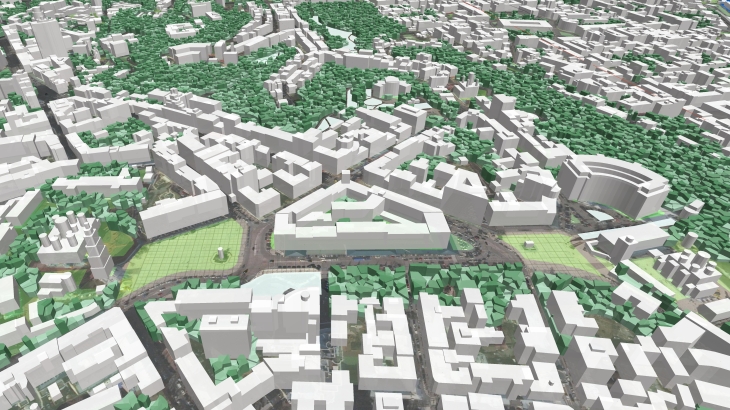
Visicom has an ambitious plan to collect a database of buildings over the country and complete a 3D model of all of Ukraine. Preliminary, we estimated that the database would contain about 20 000 000 objects, taking into account that buildings with footprint areas starting from 16 sq.m will be included. The production process is based on the technology of man-made object recognition and classification developed by our experts with the usage of ML and AI algorithms.
Our Geodata can also be used in industries such as architecture, urban planning, smart cities, solar energy, environmental management, etc.
Visicom's advanced mapping products support any RF tool format (ATOLL, PLANET, MENTUM PLANET, PATHLOSS, etc.). Our geodata made specifically for the telecom industry provide precise knowledge about the 3D environment in order to help operators to plan, implement and improve the performance of their radio networks.

