News & Events
3D Digital Maps of 86 Thailand cities for LTE, 5G, IoT
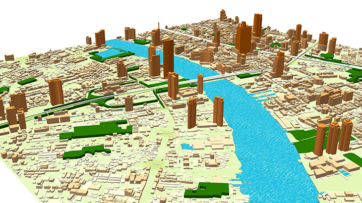
Digital Terrain Model (DTM), Digital Surface Model (DSM), Highly accurate 3D Buildings with roof details, 3D vectors of Vegetation and Bridges, Clutter/Land Use/Land Cover, Obstacles (Clutter) Heights, transportation network/roads, vector data layers and Population map. **The Thailand 3D digital map package for GIS-projects/services (BIM, IoT, smart city, a base map for navigation/land management) includes:**
3D building footprints, built-up-blocks bridges, overpasses, roads, vegetation (classified by types), POI (points of interest), hydrography, population distribution models. **3D geodata accuracy is 2-3 meters in X,Y,Z along with over than 98% completeness of buildings layer for each city .** Thailand 3D City geodata could be recalculated in any customized data format. **Download the brochure with detailed coverage of Thailand city maps** in order to explore more details. **[Our geodata catalogue][1]** includes over 4600 cities and 110+ countries. **Send us your request for more information** [1]: https://visicomdata.com/geodata-portfolio?lang=en"See our coverage of geodata "


Order product
Please, contact us directly if you have question
We always reply within 24 hours
Contact us
Please, contact us directly if you need any information