News & Events
3D GEODATA FOR HONG KONG
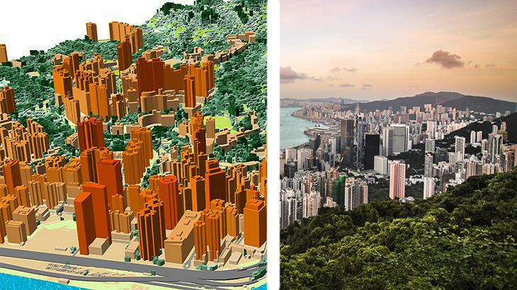
* **[3D models of Hong Kong][1] include:** - 3D buildings - small roof details, 1-2m accuracy - 3D bridges - detailed engineering constructions - 3D vegetation - with assigned height attributes *3D maps are essential for any smart GIS project. 3D data enable creating virtual urban-utility platforms to make city management more efficient. Visicom manufactures precise, geographically accurate and up-to-date 3D rendering of cities that contains all infrastructure features at various levels of detail.*
**Send us a request for more information**
[You can **download** for free **a brochure of *Hong Kong* 3D map.**][2]
[**List of OTS 3D City Models for SEA Region.**][3]
[**Please explore the 3D sample dataset of *Hong Kong* in Atoll, Mentum, ESRI formats.**][4] [1]: https://youtu.be/odwYRP6JQys?lang=en [2]: https://visicomdata.com/raw?id=13786&lang=en&lang=en [3]: https://visicomdata.com/raw?id=13816&lang=en [4]: https://visicomdata.com/samples?lang=en#china&lang=en


Order product
Please, contact us directly if you have question
We always reply within 24 hours
Contact us
Please, contact us directly if you need any information