Any single day without a new 3D project.
Visicom is pleased to introduce a new one.
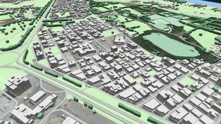
This time it is a 3D model of Oman cities for further telecom market application. Nevertheless, it can be successfully implemented in other markets and projects.
Stereo 3D City of Oman, 5 m resolution with vegetation as polygons:
City - Area:
- 3D map of Bahla - 17 km²
- 3D map of Duqm - 58 km²
- 3D map of Ibra - 43 km²
- 3D map of Ibri - 45 km²
- 3D map of Jalan Bani Bu Hassan - 66 km²
- 3D map of Nizwa - 51 km²
- 3D map of Quriyat - 10 km²
- 3D map of Salala - 86,6 km²
- 3D map of Sinaw - 10 km²
- 3D map of Sur - 39 km²
- 3D map of Tilkai - 4 km²
TOTAL: 429,6 km²
DELIVERED DATASETS:
Digital Terrain Model (DTM) / Clutter (Land Use) Model / Obstacles Heights Model – 3D Buildings and engineering construction, vegetation / Vector model / Text labels / Orthoimage

