News & Events
3D model of Kyiv (Ukraine)
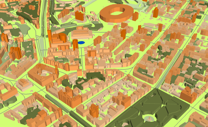
[Kyiv on Visicom online maps][3] **data for RF planning:** [2D urban model][2] of suburban area of Kyiv – 1681 sq km and built-in [3D model][1] of Kyiv – 692 sq km
**data for GIS project and WEB project:** [Map][4] of Kyiv and suburban area – 2373 sq km
Its a part of detailed [map of Ukraine][6] – 610000 sq km
Project package includes 3 types of data representation:
1. Vector data model provided as a composition of vector layers in ESRI ArcGIS or Mapinfo formats.
2. Raster data model presented in Geo-tif format and includes:
• Digital Elevation Model (DEM) (data placed in Height.tif file);
• Land Use Map (Clutter Model)
3. Service Data for RF planning tools:
• [Digital Terrain Model (DTM][5]);
• Land Use Map (Clutter Model) in matrix representation;
• Text labels;
• Vector layers.
[1]: https://visicomdata.com/products/data_for_wireless_planning/3d_models?lang=en [2]: https://visicomdata.com/products/data_for_wireless_planning/2d_urban_models?lang=en [3]: https://maps.visicom.ua/c/30.51144,50.45499,12?lang=en [4]: https://visicomdata.com/products/geospatial_data?lang=en [5]: https://visicomdata.com/products/elevation_products?lang=en [6]: https://maps.visicom.ua/c/28.98599,48.90275,6/f/ADMUA?lang=en


Order product
Please, contact us directly if you have question
We always reply within 24 hours
Contact us
Please, contact us directly if you need any information