News & Events
3D Model of Marseille, France
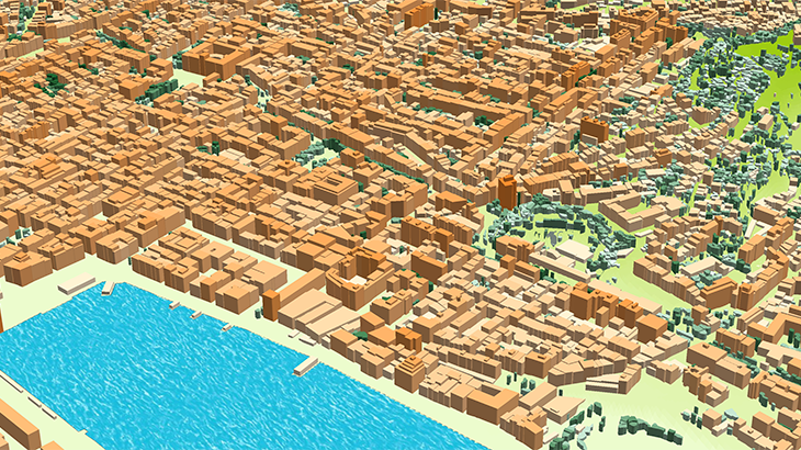
✅ 3D vegetation Model: a group of trees and individual [trees with canopy heights][2]
✅ 3D Buildings: small roof details, [sloping roofs][3], elevators shafts, tower, spires
✅ 3D Bridges with detailed constructions
✅ Our data are compatible with any propagation models
Visicom team presents 3D geodata of Marseille tailored to the new standards of advanced networks. We support requirements of 5G networks providing the best level of details featuring the for obstacles that might block or weaken the radio signals.
Please explore 3D sample dataset of Marseille ✉ Please contact us if you need some additional information
🔎 Here you can find free data samples of over 5000 cities
[1]: https://visicomdata.com/products/3d_geodata_for_5g_planning?lang=en&lang=en [2]: https://visicomdata.com/products/3d_trees_canopy_model?lang=en&lang=en [3]: https://visicomdata.com/products/3d_sloped_roofs_model?lang=en&lang=en


Order product
Please, contact us directly if you have question
We always reply within 24 hours
Contact us
Please, contact us directly if you need any information