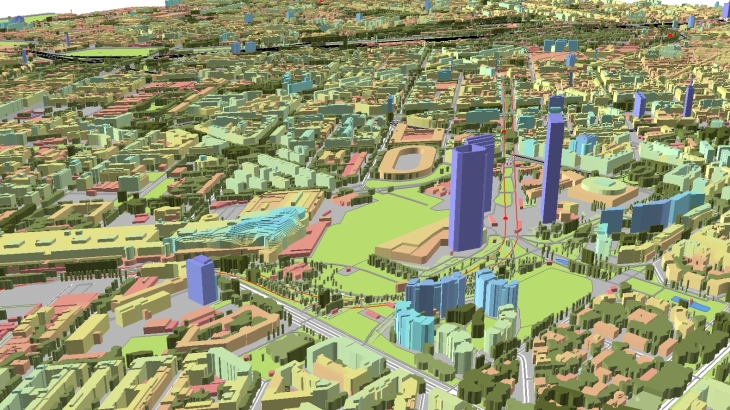
We believe that in the very nearest future, the beautiful Milan city will be accessible again for business and tourism. Meantime, you can use our precise 3D model to research and plan your business and future trips. With no doubts, if you are an RF-engineer, 3D model is the best tool for 5G planning ensuring the development of various IoT services that are actual now as never before.
The 3D city model of Milan core city was produced with a high level of accuracy and details, including a 3D Trees model tailored to the planning of new generation networks. We use recent vintage stereo imagery of 0.3 m resolution and air photos to create 1 m resolution geo-data in LoD2 quality.
Our 3D maps can be delivered in any popular format:
✅ RF-tools: Atoll, Asset, Planet, ISC Telecom, Pathloss, Nokia NetAct, NetPlan …
✅ GIS: shp, dwg, obj, rhino, skp, CAD, ESRI ArcGIS
The data sample are provided at free-of-charge by customer’s request,
We understand the precise geodata requirements that must be met to design next-generation networks in mmWave frequencies range. We also support vertical markets like Smart cities, Transportation, Environmental management, etc. Based on our 20-years experience, we offer the most cost-effective solution for any territory and in accordance with your budget.
We also propose 2D Urban Model, 2.5D Urban Models 2D Regional Models with clutter height with 5, 10, 20 m resolution, with DTM, clutter (land use) and vector layers for RF-planning in suburb.


