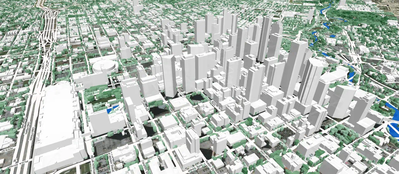
3D MAP FOR HUSTON USA
Visicom team added one more 3D RF-map to our growing portfolio - 1 m resolution 3D model of Huston city for 5G planning.
The model accuracy in XYZ – 2 m LE95.
3D obstacles include 3D Buildings, Trees and Bridges as well as other artificial objects, vector layers like roads/streets network and Land Use classified in 28 classes. All these elements together provide the accurate and detailed representation of city infrastructure that is obvious source for accurate RF planning and task management in other industries such as architecture, smart cities, solar energy etc.
Visicom, having long-term experience in 3D map development, constantly improves the technology and quality of geodata production providing our customers with fast delivery of high-quality 2D and 3D maps, population maps and any other spatial.

