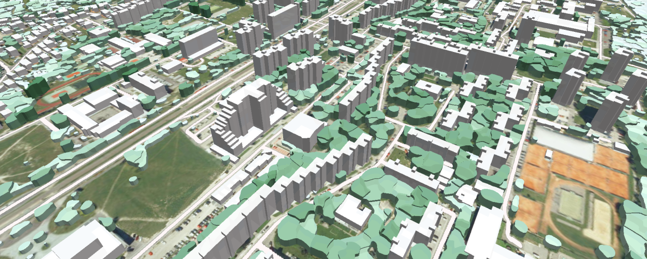
The project we recently completed involved creating a comprehensive 3D model of Slovakia with a resolution of 5 meters.
We have used advanced machine learning and deep learning techniques to ensure high accuracy and speed of production, providing a solid platform for future technology and infrastructure development and environmental initiatives. This project supports sustainable growth and enhances the quality of life in Slovakia.
What is included in the 3D map?
- 48,868 square kilometers of the country's territory with 3D buildings at LoD1.3 detail level, which provides detailed information on the structure and height of each building
- Population Data of the quantity and density of people. The model integrates population data for each building based on the latest census. Detailed administrative division boundaries are provided to the municipality level, allowing for accurate demographic and administrative analysis.
- Address database. The model includes a complete address database for the whole of Slovakia, which facilitates geolocation services and urban planning.
- Digital Terrain Model (DTM) provides detailed elevation data, which is important for various applications such as flood modeling, construction planning, and environmental monitoring.
- 22 land use classes (Clutter) - building types, forests, water bodies, industrial zones, agricultural land
- Clutter Height. Height attributes for each 5mx5m grid element are also included, adding another level of detail for urban and environmental analysis.
- 3D vegetation vectors, which are essential for the accurate modeling of 5G networks. Our machine learning methods, developed based on convolutional neural networks (CNN) and deep learning techniques, allow us to model tree canopies for the entire country quickly and with high accuracy
- The 3D vectors of 15,900 bridges, including height and thickness attributes, are part of a dataset that improves the planning and maintenance of transport infrastructure.
This geodatabase is ideal for deploying 5G networks in cities or highly urbanized areas and suburbs and designing networks across the country.
The model covers all major cities in Slovakia, ensuring comprehensive urban analysis capabilities: Banska Bystrica, Bardejov, Bratislava, Humenne, Komarno, Kosice, Levice, Liptovsky Mikulas, Martin, Michalovce, Nitra, Nove Zamky, Poprad, Povazska Bystrica, Presov, Prievidza, Spisska Nova Ves, Trencin, Trnava, Zilina, Zvolen
The comprehensive nature of this 3D model makes it suitable for various applications, including:
- 5G Network Deployment: Accurate modeling for city and countrywide network design.
- Urban Planning: Detailed building and population data for planning and development.
- Environmental Monitoring: High-resolution terrain and vegetation data for environmental assessments.
- Infrastructure Development: Precise data on bridges and other structures for planning and maintenance.
Sample data can be provided upon request. Free test data in Atoll format can be downloaded directly from our website at https://visicomdata.com/samples?country=sk


