Map Of Tunisia
- 2D regional model, 10m resolution for the countrywide – 167,000 sq.km
- day and night population distribution model, 10m resolution for the entire country
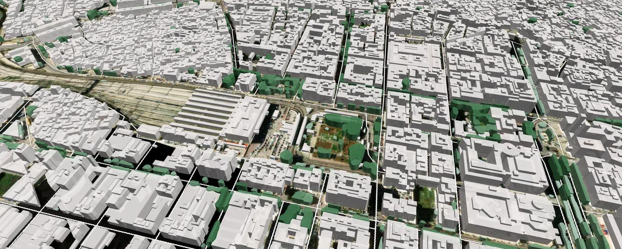
- 3D city maps, 5m resolution for cities Tunis, Bizerte, Nabeul, Sfax, Sousse
Highly-accurate digital models of urban and rural areas is essential for mmwave network development. Our maps will help operators plan 5G networks accurately, and achieve maximum coverage and capacity, choosing the best location for their base stations.
3D maps identify all artificial and natural obstacles – buildings, trees, bridges and overpasses.
A precise terrain model and detailed land use and road network classification together with a population distribution model help you set optimal sites for 5G cells across the entire country.
All geodata were produced based on the most up-to-date satellite images.
Our data are delivered in all major RF planning software – planet, atoll, asset, etc.

