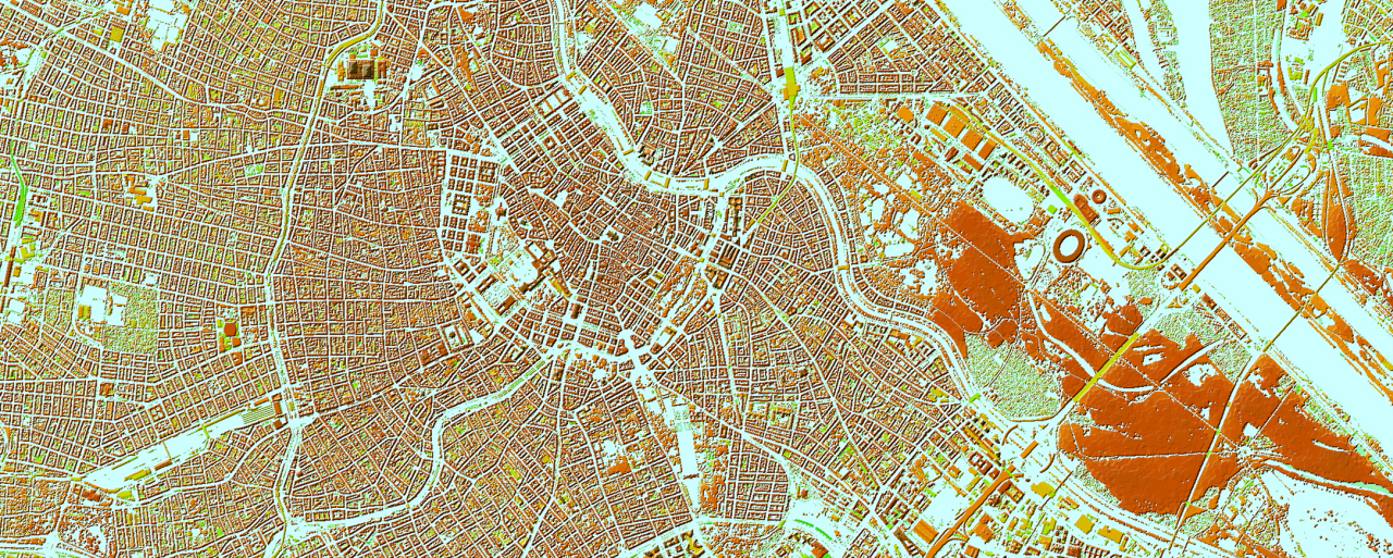
The geospatial data accuracy and specification requirements for 5G radio propagation and optimization are much higher than those used in planning 3G and 4G networks. The recommended geospatial data resolution of 1–2 meters allow visualizing the smallest parts of geospatial objects. 3D models usually used for 5G city planning contain the following layers: DTM, Land Use model, Clutter Height model (DHM), linear vectors, 3D vectors of Buildings, Bridges, and Vegetation and optionally – DSM.
Clutter height data (DHM), used in conjunction with high-quality clutter and terrain data, is an important additional geodata option for engineers who conduct radio designs. The 1m or 2m resolution DHM provides an estimate of the obstacle's height on a per-cell basis. It offers a much more accurate representation of the diversity of heights within clutter classes and results in improved predictions. The Clutter Height layer is widely used in the most popular RF-planning tools and corresponding propagation models. Clutter Height or DHM is used separately as well as in conjunction with DTM (bare terrain). The combination of DTM and DHM is well-known as DSM – a set of elevation values of the Earth’s surface, including artificial and natural objects (like trees).
Here, we describe the technology and methods of accurate clutter height matrix production for the purposes of 5G radio network development and optimization. Our goal is to reconstruct urban environment with all 3D object that serve as obstacles for the radio wave propagation in the raster representation.
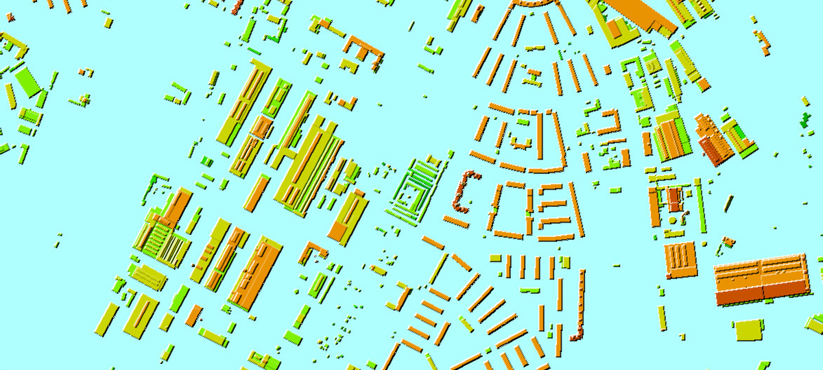
Clutter height or Digital Heights Model (DHM) is a matrix of the artificial objects (obstacles) like buildings, man-maid constructions and also vegetation with the relative height attribute. The technology of clutter height production is mainly based on height measurement of obstacles by high-resolution stereo satellite or aerial images processing.
The 1st step is a buildings outlines and heights extraction. We use deep learning model based on CNN trained on the set of high-resolution satellite images and airborne photos and as input - stereo-pairs of 0.3-0.5 m resolution to define building contours and common heights.
In dense urban areas, particularly in central business district (CBD) areas, where buildings often have complex architectural forms, the next crucial step involves additional manual processing of the stereo images. This process employs stereo photogrammetric methods for vectorization and height measurement, focusing on:
- Roof details
- Facade structures
- Individual components of buildings, which may vary in height and possess intricate shapes.
The result is an array of building outlines, with each element of 3m x 3m size has a different height.
For trees, we train the same AI model as for buildings, which distinguishes between tree crowns of 3m x 3m and adds an individual height to each contour.
Afterward, all gathered 3D object layers are combined and rasterized into a matrix with a 1m x 1m or 2m x 2m cell, creating a set of individual elevation values for each matrix cell. The Clutter Height Model provides the relative height of each cell with an accuracy of 2-3 meters.
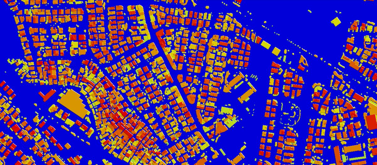
If required for a specific customer's project, the 3D objects are put on the ground (combined with DTM) to obtain the resulting DSM layer (Digital Surface Model) with absolute height values in a matrix format.
This approach is the most straightforward and convenient for creating 3D models, as the 3D obstacle layers are already provided, and the clutter height is a derived layer.
An alternative approach is to generate DSM data from multiple high-resolution satellite imagery or aerial images, which can also be adapted to use LiDAR data. Since network planning always requires a separate DTM (digital terrain model) and a separate DHM (digital height matrix), the DTM extraction from DSM algorithm should be used, i.e., the DSM should be properly cleaned from artificial structures and vegetation.
This is a well-known problem in the digital industry, and existing solutions are not accurate enough for the needs of 5G planning in dense urban environments. Existing methods are not straightforward, using deep learning algorithms to detect objects and only provide reliable results if the terrain is sufficiently flat. Additional processes include removing noise inherent in the DSM and matching the water feature layer to the resulting DTM. Both processes are not automatic, but semi-automatic with further manual correction. Finally, clutter heights are extracted as DHM=DSM-DTM. This is enough to create clutter heights data for 2.5D city models. However, when it comes to 3D models for dense urban development, further recognition of buildings and vegetation and measurement of their heights is required.
Thus, this method, which is more automated in the early stages, requires more refinement and manual processes to produce the final data set.
Clutter height data together with other geodata sets - DTM, Clutter/Land Use, Water objects, linear vectors of street/road networks, 3D buildings and vegetation - provide a complete 3D reconstruction of the urban environment using modern methods of processing stereo pairs of satellites and aerial images by Convolutional Neural Network (CNN) model trained with available sources for further deployment of the obtained results tailored to country specifics. Developed AI-powered algorithms that extract high-precision map features from satellite imagery, significantly improving efficiencies in data creation.
Our geodata supports companies worldwide, helping them make geospatial analyses based on best-quality maps.

