3D maps of Taiwan cities for cellular networks planning and other markets
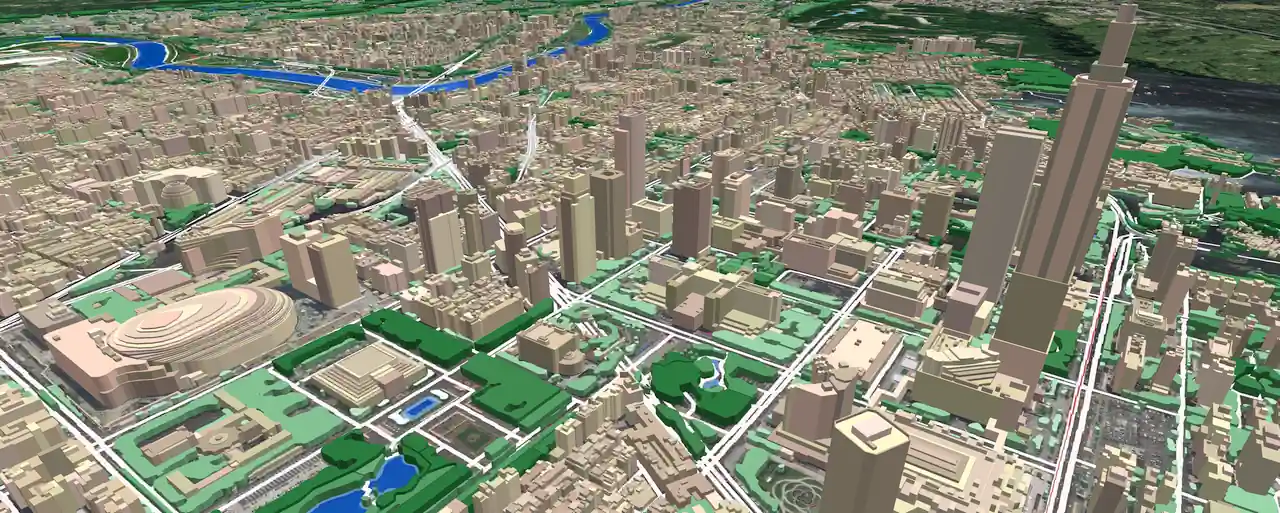
🔔We would like to introduce you to our products for Taiwan, that now cover the all major cities. There are 3D models that include high-resolution 3D buildings and vegetation, road networks, terrain data and landscape.
Visicom® produces high-level geodata for 5G planning because we have 20 years of experience to cooperate with telcos and operators worldwide. That is why you can be sure of the quality of our products.
In 2 months, 3D model of 2 m resolution for the all territory of Taiwan will be completed. Visicom's advanced mapping products support any RF tool format (ATOLL, PLANET, MENTUM PLANET, PATHLOSS etc.). Our geodata made specifically for telecom industry provide precise knowledge about the 3D environment in order to help operators to plan, implement and improve the performance of their radio networks.
Now 12 cities and their suburb are ready in 3D, namely:
✅ 3D maps of TAIPEI CITY and NEW TAIPEI
✅ 3D map of KAUSHUNG
✅ 3D map of TAICHUNG
✅ 3D map of HSINCHU
✅ 3D map of TAINAN
✅ 3D map of TAOYAN
✅ 3D map of PINGTUNG
✅ 3D map of LINYAN
✅ 3D map of GANGSHAN
✅ 3D map of HUALIEN
✅ 3D map of XIHU
✅ 3D map of CHAGHUA
The total covered area is about 1500 sq.km. More cities will be available soon.

