News & Events
Countrywide map of Algeria 2D
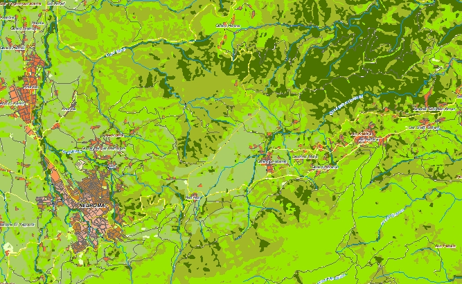
Please download the [data sample of Algeria][1] project and [data specification][2] **[data for RF planning][3]:** [2D Regional Model][4] of Algeria – 2325731 sq km
and **[data for GIS project and WEB project][5]:** [Map][5] of Algeria – 2325731 sq km
Map Project package includes such datasets as:
• [Digital Terrain Model (DTM][6]);
• Land Use Map (Clutter Model) in matrix representation;
• Text labels;
• Vector layers.
• Population map for Algeria (whole country) [1]: https://visicomdata.com/samples?lang=en#algeria "Sample of Algeria geodata" [2]: https://visicomdata.com/raw?f=Algeria_package_Visicom_2017.pdf"Brochure of Algeria map for RF planning" [3]: https://visicomdata.com/products/data_for_wireless_planning?lang=en"See more about the map for RF planning" [4]: https://visicomdata.com/products/data_for_wireless_planning/regional_models?lang=en"See more about a regional model for RF planning" [5]: https://visicomdata.com/products/geospatial_data?lang=en"See more about vector map" [6]: https://visicomdata.com/products/elevation_products?lang=en"See more about the type of elevation models"


Order product
Please, contact us directly if you have question
We always reply within 24 hours
Contact us
Please, contact us directly if you need any information