The mining industry is one of the most resource-intensive and simultaneously one of the most complex in terms of environmental impact. Every year, around 100 billion tons of minerals and metals are mined globally, and this figure continues to grow. In such a high-load environment, effective management of extraction, risk monitoring, and minimizing environmental harm become critically important.
The activity of surface mineral extraction causes significant changes in soil cover and land use within the mining area. Large volumes of waste material are excavated, leading to permanent changes in topography.
Minimizing the mining footprint and transitioning the entire industry toward sustainable mineral extraction are key drivers of advanced mine monitoring.
Regular long-term observation of the surface and facilities located in the extraction zone is essential to ensure the safety of mining operations and to minimize negative environmental impact.
A Digital Twin is a modern approach to visualizing, analyzing, and managing mining operations. It involves transferring the real image of the mining area and its surroundings – including buildings, infrastructure, machinery, and sensors – along with relevant data about these elements into an integrated system, creating a digital replica of the entire environment.
During the mining phase, mapping serves as a highly valuable tool for maximizing extraction efficiency. Mining companies can ensure effective transportation of extracted resources, manage fleet logistics, and monitor the condition of their equipment by utilizing tracking and monitoring systems.
What does a digital twin of a mining object include?
- 3D modeling of buildings and infrastructure
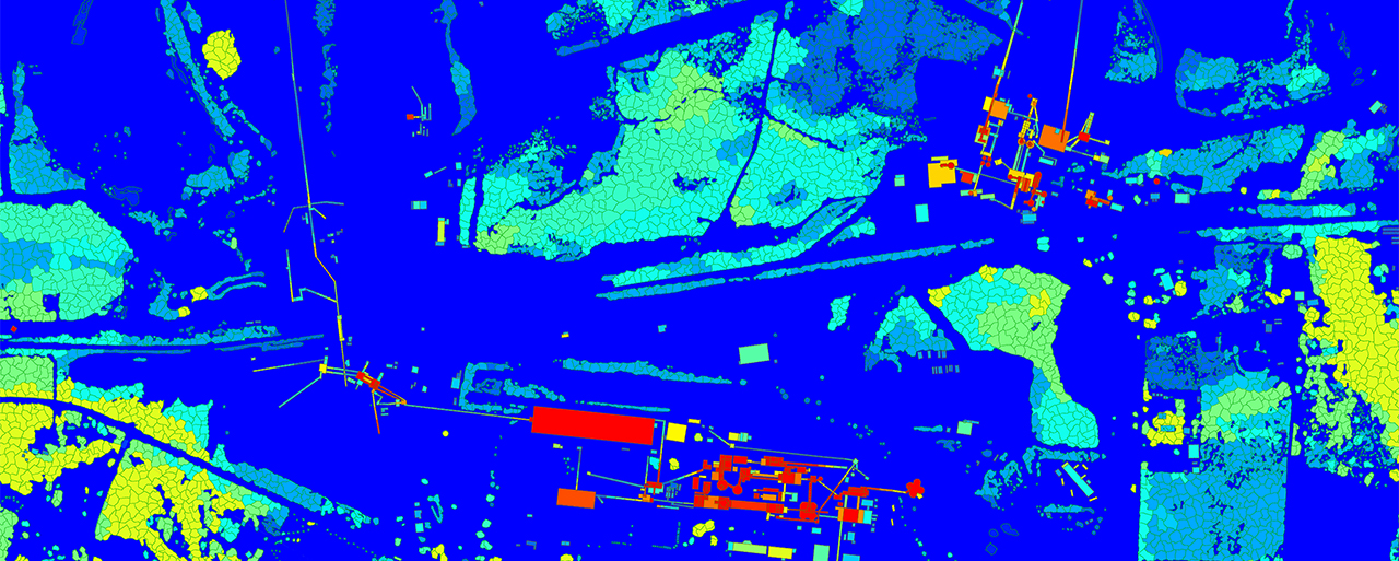
VISICOM creates high accurate digital models of quarries, dams, roads, buildings, and engineering objects based on geospatial data, satellite imagery, and topographic information. - Buildings with LOD1-LOD2 level detail
Detailed modeling of roof shapes and facades ensures precision in infrastructure design and telecommunications planning. - Digital Terrain Models (DTM)
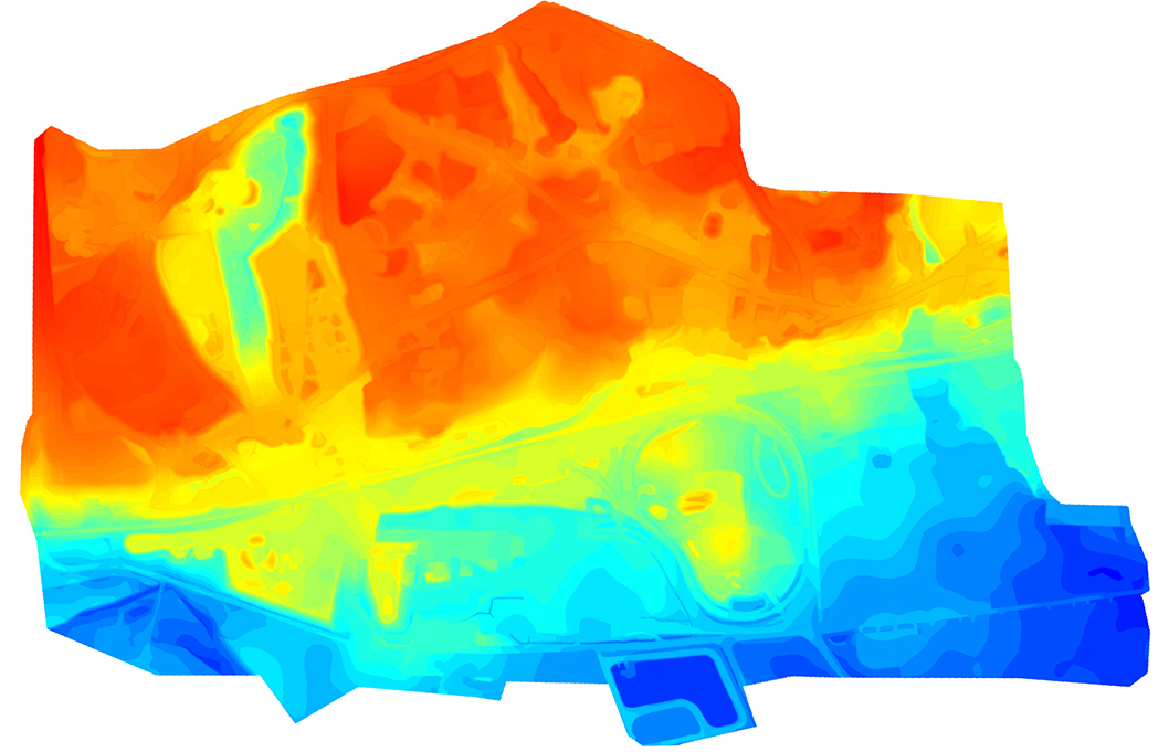
A detailed terrain model is a critical part of any 3D model for mining areas. It is essential both for mining operations and for the deployment of private 5G networks within extraction zones. It includes not only the natural terrain but also quarries, waste heaps, and tunnels. - 3D vegetation models with seasonal variations
Green areas are modeled to enable accurate calculation of 5G signal loss during different times of the year. - Detailed road network
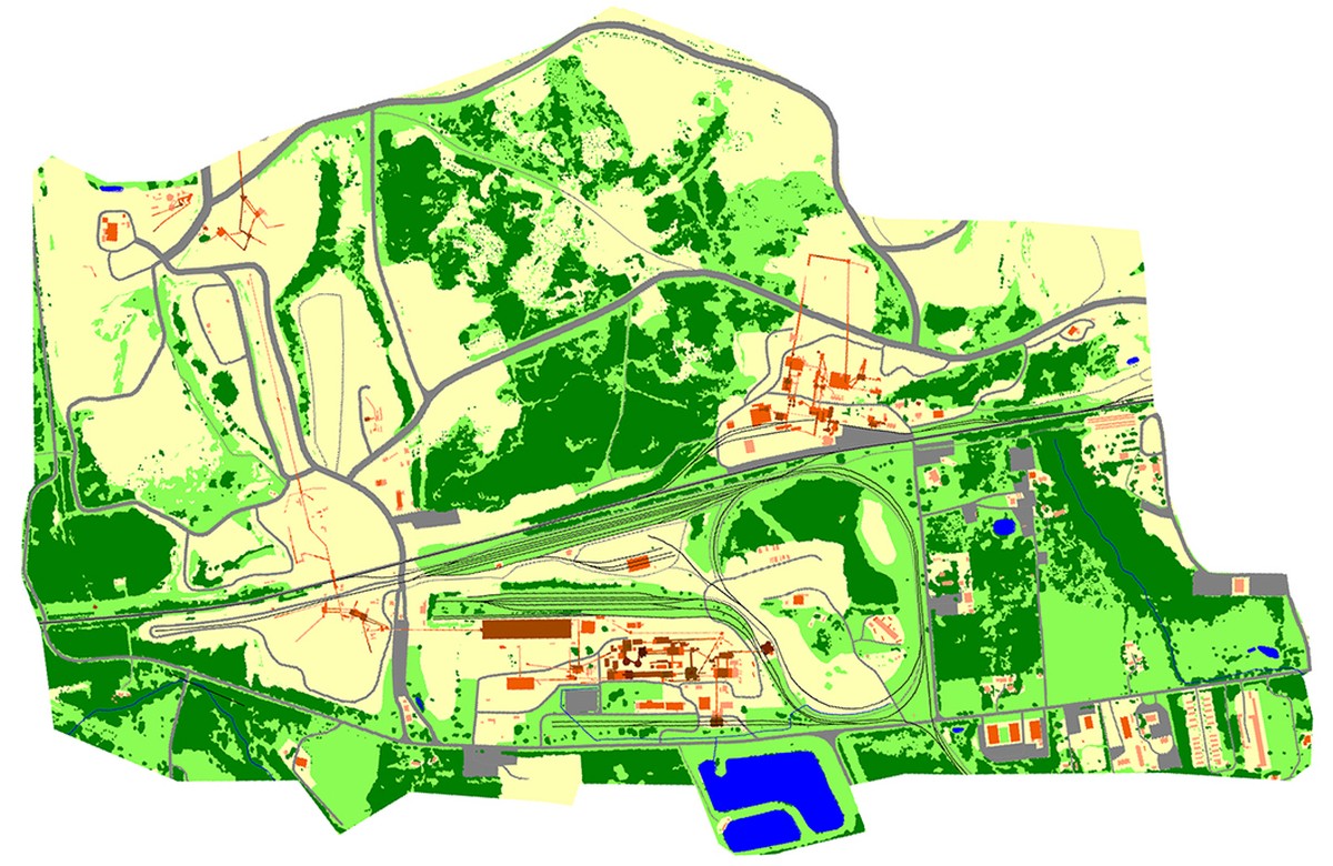
Up-to-date, high-precision vector maps support logistics planning and access control to facilities. - High-resolution orthophotos
Used as a foundation for the production of 3D models.
Areas of application for a digital twin of a mining object:
1. Geology and exploration
- Modeling development zones and planning drilling operations
- Assessing site accessibility and planning transport routes
- Considering terrain features and environmental restrictions
2. Planning and design of 5G networks
- Specifics of Standalone 5G implementation in complex mountainous terrain:
- mmWave signals have low penetration, making precise placement of base stations critically important
- Due to the terrain complexity, 3D models are used for:
- Line-of-sight analysis
- Obstruction mapping (buildings, vegetation, terrain)
- Optimal placement of small cells
- Interference management
3. Environmental monitoring
- Modeling environmental impact
- Risk prediction: landslides, flooding, pollution
- Planning for reclamation and land restoration activities
4. Transport management
- Optimizing resource delivery routes
- Monitoring fuel consumption and logistics efficiency
Visicom's 3D Digital Models for Mining provide an optimal balance of high resolution, quality, and cost-effectiveness. By combining data derived from high-resolution stereo images with advanced processing algorithms, these models serve as an efficient tool for professionals in industries related to mineral extraction.
Our Digital Terrain Models (DTM) as a critical component for planning and analysis, enables industries to make informed decisions based on accurate and up-to-date cartographic data.
We produce highly accurate global 3D data to ensure the efficiency and reliability of your geospatial projects.

