The Balkan Peninsula, with its rich history and diverse landscapes, presents unique challenges and opportunities for industries that rely on geospatial data. From the rugged mountains of Montenegro to the sprawling urban areas of Turkey, the region's varied terrain and cultural heritage demand tailored solutions for effective planning and decision-making. VISICOM has a unique opportunity to meet these needs by offering comprehensive geodata at all levels, customized for any industry, with a particular focus on radio frequency planning.
A wide range of geospatial resources allows us to offer ready-to-use data for industries such as telecommunications, urban planning, environmental management, and utility planning for Greece, Kosovo, North Macedonia, Romania, Serbia, Turkey, Croatia, and Montenegro.
We provide comprehensive, accurate, and up-to-date vector maps, including the following geodata layers:
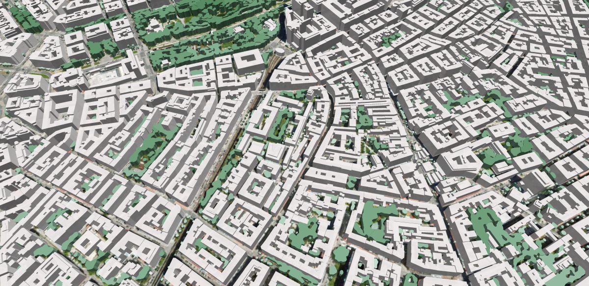
- 2D and 3D Building footprints
- 3D Vegetation
- 3D Bridges
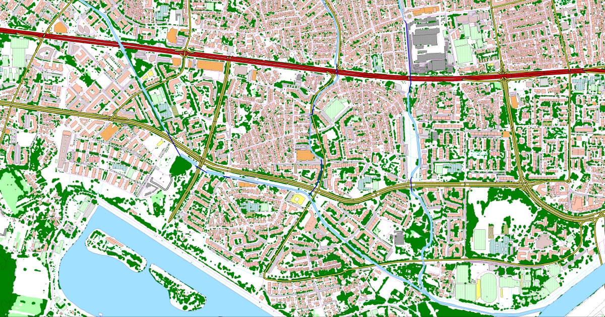
- Road and Street Networks
- Railways
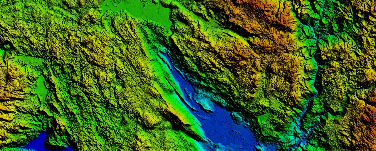
- Digital Terrain Models
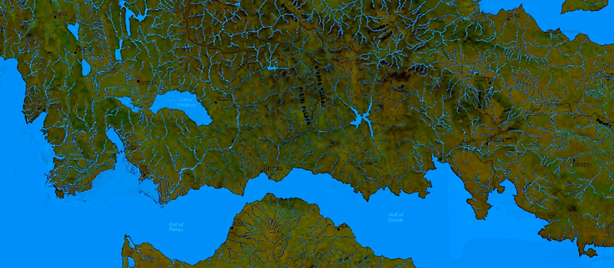
- Hydrography
- Administrative Boundaries
- Population Data
- Postal Code Polygons
- Address Databases
Each country in the Balkans has its own unique geographical features that influence how geodata should be utilized:
- Greece: With its thousands of islands and mountainous mainland, Greece requires to be detailed coastal and topographical data to support maritime navigation, urban development, and environmental conservation efforts.
- Kosovo: As a landlocked region with complex political boundaries, Kosovo benefits from geospatial data that aids in infrastructure development, border management, and agricultural planning.
- North Macedonia: Known for its mountainous terrain, North Macedonia relies on geodata for natural resource management, disaster preparedness, and urban expansion, particularly in the Skopje region.
- Romania: Romania's mix of Carpathian Mountains, fertile plains, and the Danube Delta requires geodata to support diverse industries such as agriculture, forestry, and tourism, alongside urban planning in rapidly growing cities like Bucharest.
- Serbia: Serbia's strategic position along the Danube and its varied topography necessitate comprehensive geospatial data for transportation planning, water resource management, and rural development.
- Turkey: Spanning two continents, Turkey's vast and varied landscapes—from the bustling cities of Istanbul and Ankara to the rugged terrain of eastern Anatolia—demand precise geospatial data for infrastructure development, urban planning, and environmental monitoring.
- Croatia: With its extensive coastline along the Adriatic Sea, Croatia requires coastal geodata to support maritime activities, tourism, and urban development in cities like Split and Dubrovnik.
- Montenegro: Known for its mountainous regions and picturesque coastline, Montenegro relies on geodata for sustainable tourism development, infrastructure projects, and environmental protection.
We understand the specific needs of each country in this diverse region and have data that precisely meets those needs. From detailed elevation models to comprehensive land use data, our offerings cover every level required for the successful implementation of a project.
Radio Frequency Planning: The diverse terrain of the Balkan region and dense urban development pose significant challenges for radio frequency planning. With our geodata, you can accurately model signal propagation and optimize networks for both coverage and capacity. Our geodata enables precise signal propagation modeling, helping telecom operators optimize their networks for both coverage and capacity. Whether it's the mountainous areas of Serbia or the crowded urban centers of Turkey, our data ensures that RF network planners have the tools necessary to deliver reliable services.
GIS:
From environmental monitoring to infrastructure development, GIS is an essential tool for managing the complex landscapes of the Balkans. Our geodata is available in all necessary layers and combinations, customized to meet the specific needs of any project.
Our geodata is particularly valuable for the transportation sector, where accurate and comprehensive data is crucial for planning and development. We specialize in creating 3D buildings at LOD1 - LOD2 levels, as well as 3D vegetation and other geodata necessary for urban planning, risk assessment, and environmental management. Our data supports:
- Road infrastructure planning
- Urban environment planning
- Airport and railway network planning
- Solar energy development
- Real estate management
- Geomarketing
- Emergency services operations
Here are some futures from our implemented projects:
- 7 million 3D Buildings
- 15,700 3D Bridges
- 77,000 km of Water objects (31 different classes)
- 2 million Addresses
- Samples
Croatia
- 4.3 million 3D Buildings
- 124,738 km of Water objects (Croatian and English languages)
- 2 million Addresses
- Samples
Turkey
- 25.2 million 3D Buildings
- 3 levels of Administrative Boundaries: 81 provinces, 972 districts, 48,543 municipalities
- Samples
The Balkan Peninsula is a region of immense strategic importance, where geography and infrastructure intersect in a complex and dynamic way. Whether it’s 3D mapping for urban development in Romania, solar energy planning in Turkey, or infrastructure projects in Greece, our data enables industries to achieve their goals with precision and confidence. Our commitment to providing high-quality geodata ensures that your projects are built on reliable and detailed information, tailored to the specific requirements of each country.

