News & Events

GEODATA OF GREENLAND CITIES

3D MODELS OF GREENLAND FOR 5G PLANNING -------------------------------------- The aim of the project: 3D digital maps for radio planning purposes, 3D cities map area: 54.3 sq.km.
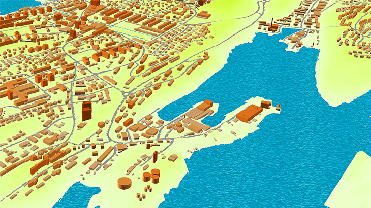
3D models have been obtained by neural network algorithms, which were used for 3D features recognition and height detection.
The final datasets were optimized using machine learning algorithms and finalized by semiautomatic verification procedures at the final stage.
3D City Models, 2 m resolution:
Aasiaat, 4 sq.km
Illussat, 8 sq.km
Kangerlussuaq, 9 sq.km
Kulusuk, 1sq.km
Maniitsoq, 4 sq.km
Nanortalik, 2 sq.km
Narsaq, 4 sq.km
Nuuk, 14 sq.km
Paamiut, 3 sq.km
Qaqortoq, 2 sq.km
Sisimiut, 7 sq.km
Tasiilaq, 2 sq.km
Upernavik, 2 sq.km
Uummannaq, 2 sq.km
The 3D city models include the following geopackage content: - DTM - Clutter model/ Land Use - Obstacles Height Model as a matrix comprising buildings and engineering constructions - Vector model featuring precise 3D building footprints - Text Labels ✉ Please contact us if you need some additional information.
🔎 Here you can find free data samples of over 5000 cities. [VISICOM'S GEODATA][1] [1]: https://visicomdata.com/geodata-portfolio?lang=en Back to all news

Order product

Please, contact us directly if you have question

We always reply within 24 hours

By using this contact form, you consent with our Privacy Policy