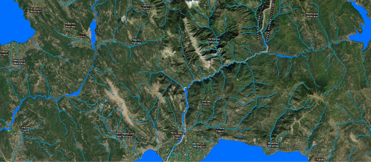
The National coverage of water objects realized by Visicom is a high-precision vector map generated by leveraging our AI-based algorithms developed for high-resolution satellite images processing.
Covering 131 957 sq. km (water map of Greece) across the country, Visicom’s database of water objects provides an accurate and up-to-date digital representation of the water environment including:
- rivers, lakes, springs, swamps, lagoons, ditches and other objects categorized into 31 different classes;
- totally we collected about 77000 water objects featuring individual names in English and Greek.
This unique dataset serves as the foundation for many land use and city planning applications, telecom as well as for a diverse range of environmental management tasks, namely:
- Climate change mitigation
- Flood mapping
- Green infrastructure deployment
Visicom, having many years of experience in 3D map creation, constantly improves the technology, quality, and speed of production, which allows us to provide our customers with high-quality 2D maps, 3D maps, population maps, and any other spatial data in a short time.
More information about Greece's geodata
3D buildings of Greece countrywide
Download the free data sample of Greece

