News & Events
Havana 3D map project for RF Planning
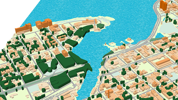
It is one more step of **Visicom intensifying walk into Americas map market.** **Havana Geodata Dataset contains:** Digital Terrain Model (DTM), Digital Surface Model (DSM), highly accurate 3D Buildings with roof details, 3D Vegetation and Bridges, Clutter/Land Use/Land Cover Model, Obstacles Heights (Clutter Heights) Model, Vector model, Transportation networks and Population map.
**3D geodata accuracy – 2-3 m in X,Y,Z.** In addition, Havana 3D map package could be used for any GIS, IoT planning projects, all data formats are supported. **Download the free data sample of Havana digital model** in order to explore more details. **[Our geodata catalogue][1]** includes over 4000 cities and 80+ countries. **Send us your request for more information** [1]: https://visicomdata.com/geodata-portfolio?lang=en"See our coverage of geodata "


Order product
Please, contact us directly if you have question
We always reply within 24 hours
Contact us
Please, contact us directly if you need any information