Throughout 2023, our dedicated team worked tirelessly to complete many large-scale mapping projects, each tailored to different type of models and countries worldwide.
From completion of ambitious mapping projects to introducing cutting-edge technologies, the year has been marked by significant accomplishments.
From Australia to Newfoundland, we support our clients with up-to-date and high-quality maps for 5G network planning.
Our completed projects:
- 2D Country Maps for Regional Planning, created for 14 countries and covering a total area of about 7 456 583 sq.km
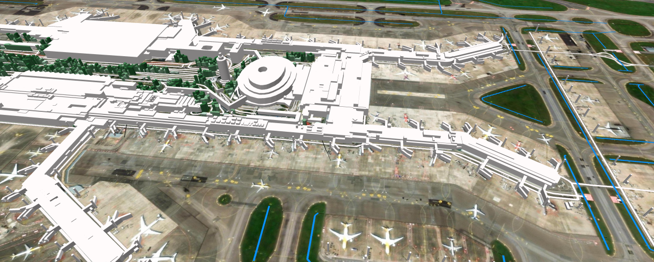
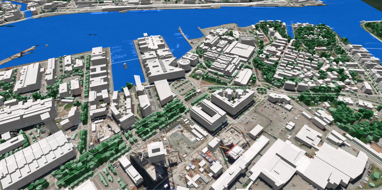
- 3D Countrywide models for 7 countries (details in our blog and articles on Medium)
- 3D City Models with 1 m resolution covering 9 231 sq.km
- 2.5D Models with 5 m resolution covering 54 691 sq.km
- 2D City Models spanning 169 860 sq.km and covering nearly 1000 cities
- Population Density Maps for 21 countries
In addition, we executed projects preparing 3D buildings for GIS projects in various industries:
- Logistics
- Marketing
- Deployment of fiber-optic communication lines
- Real Estate
- Solar Energy
- Environmental Management
For these projects, we produced 150,000,000 3D buildings for Turkey, UAE, Vietnam, Thailand, Mexico, and several European countries throughout the year.
A separate focus of our work was creating LOD 2.1 buildings tailored for solar energy assessment for Belize, Burkina Faso, El Salvador, and Uzbekistan. Learn more about it here
Project highlights and technological advancements for 2023:
Thanks to the implementation of advanced deep convolutional neural networks (CNN) and AI-algorithms we achieved a remarkable level of accuracy compatible to manual source data processing. The incorporation of AI-algorithms not only enables quick extraction of cartographic features but also proves effective across extensive geographical areas. The CNN support extraction of accurate special information about buildings, vegetation and water objects within cities, urban areas and even for a whole country what is very important as for 5G networks planning as for city planning tasks, environmental monitoring projects and other GIS projects.
What are our future plans?
In the dynamic realm of mapping, our future vision centers around pioneering advancements that seamlessly integrate artificial intelligence, 3D technologies, and data analytics. We aspire to lead the industry by anticipating trends, adapting to change, and setting new standards in accuracy, efficiency, and environmental awareness. As we navigate the evolving landscape of mapping, we envision a future where our innovations not only meet but exceed the expectations of our clients and stakeholders.
In these challenging times for our country, our customers believe in us and our ability to accomplish the projects with traditional high level of quality. We are very thankful to all our friends and partners for their unwavering support and confidence in our reliability.
For free samples and more information about 2D/2.5D/3D geodata, please feel free to contact us or download the samples directly from our website.

