News & Events
POPULATION MAP OF OMAN
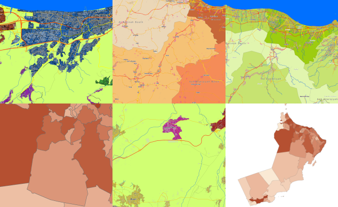
**data for RF planning:** [Population Map][1] of Oman – 309000 sq km
and **data for GIS project and WEB project:** [Vector Map][2] of Oman – 309000 sq km
Project package includes 3 types of data representation:
1. Vector data model provided as a composition of vector layers in ESRI ArcGIS, MapInfo or any other GIS formats. 2. Raster data model presented in GeoTIFF format. 3. Service Data for RF planning tools. Please download the free data sample of [Oman][3] project. [1]: https://visicomdata.com/products/population_data?lang=en "Population data, Population Map, Data for RF planning" [2]: https://visicomdata.com/products/geospatial_data?lang=en "Geospatial data, GIS, vector map, ESRI, MapInfo" [3]: https://visicomdata.com/samples?lang=en#oman "RF Map of Oman, Map of Oman"


Order product
Please, contact us directly if you have question
We always reply within 24 hours
Contact us
Please, contact us directly if you need any information