News & Events
Romania countrywide map project for telecom operator
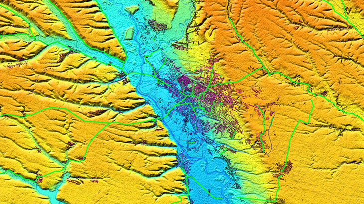
The Romania digital map covers the whole territory of the country (238 000 sq.km) with 10m resolution quality. It's the best solution for the initial network planning and network planning in rural areas. **The Romania digital map includes such datasets as:**
1. Digital Terrain Model/DTM 2. Clutter/Land Use Classification/Land Cover Model 3. Vector Model (detailed road network
4. Population map as grid (matrix) and vectors with blocks of populated areas
5. The detailed administrative division for whole country In order to satisfy the upcoming 5G implementation were additionally produced the highly accurate 3D models with a 1-2 m resolution of the biggest Romania cities. Please explore more regarding **["Romania 3D city digital maps"][2]** and **["Bucharest 3D city model"][3]**. Romania digital model could be used as a GIS and base map for LTE planning and simulation, IoT, land planning, population distribution modelling. **Send us the request for more information** [1]: https://visicomdata.com/products/data_for_wireless_planning/regional_models?lang=en [2]: https://visicomdata.com/news/3d_geodata_for_major_romanian_cities?lang=en "Romania 3D city digital maps" [3]: https://visicomdata.com/news/3d_geodata_for_bucharest_city_romania?lang=en "Bucharest 3D city model" [4]: https://visicomdata.com/raw?id=10938&lang=en" booklet about the project "Telco map for Romania"


Order product
Please, contact us directly if you have question
We always reply within 24 hours
Contact us
Please, contact us directly if you need any information