News & Events
Sacramento 3d digital map for LTE, 5G, IoT/ US market case study
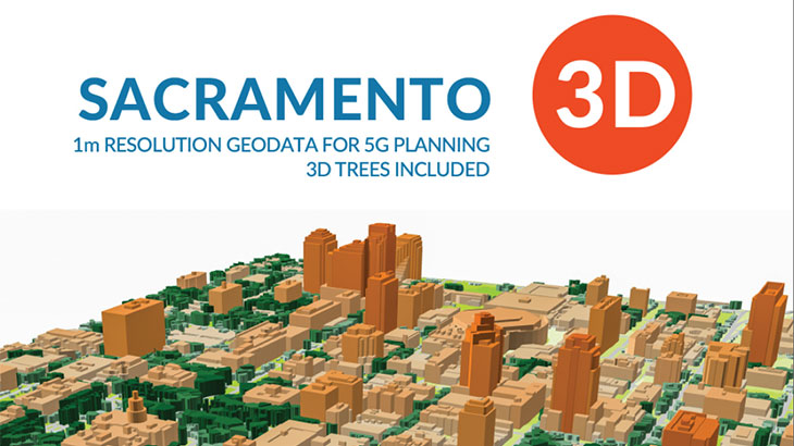
Digital Terrain Model (DTM), Digital Surface Model (DSM), Highly accurate 3D Buildings with roof details, 3D vectors of Vegetation and Bridges, Vector Trees Model, Clutter/Land Use/Land Cover, Obstacles (Clutter) Heights, transportation network/roads, vector data layers and Population map. **The Sacramento (US) 3D digital map package for GIS-projects/services (BIM, IoT, smart city, a base map for navigation/land management) includes:**
3D building footprints, built-up-blocks bridges, overpasses, roads, vegetation (classified by types), POI (points of interest), hydrography, population distribution models. **[Our geodata catalogue][1]** includes over 4600 cities and 110+ countries. **Send us your request for more information** [1]: https://visicomdata.com/geodata-portfolio?lang=en"See our coverage of geodata "


Order product
Please, contact us directly if you have question
We always reply within 24 hours
Contact us
Please, contact us directly if you need any information