The potential of artificial intelligence (AI) to transform business, industry, and society
The potential of artificial intelligence (AI) to transform business, industry, and society has been growing over the decades. Regarding commercial real estate, it is evident that the strategic application of AI can reshape this sector. Artificial intelligence ranks among the top three technologies expected to have the greatest impact on real estate over the next three years by investors, developers, and corporate tenants.
The vast amount of data generated by the digital revolution can now be utilized and analyzed by artificial intelligence. This process helps generate powerful ideas that shape the future of real estate.
Today, technological solutions exist for almost every aspect of real estate functions, including investment management, design and construction, building and facility management, and so on.
3D visualization is the most commonly used tool in the real estate industry. Accordingly, 3D Mapping is the basis for most real estate management tasks.
3D Digital Mapping in the real estate sector
3D Digital Mapping in the real estate sector is a technology used to create three-dimensional visualizations of real estate properties and landscapes. It offers unprecedented opportunities for visualization and valuable information for various stakeholders involved in real estate management and urban planning.
Urban planners and architects can use this information to assess the feasibility of new construction projects, model urban design scenarios, and optimize land use strategies. In addition, 3D Mapping can help with environmental assessment and disaster planning by accurately modeling terrain features and potential hazards.
The use of artificial intelligence algorithms streamlines the process of data collection, processing, and analysis required for creating 3D digital maps. Machine learning methods applied to high-resolution satellite imagery processing reduce the time and effort needed to create 3D building models ranging from LoD 1.2 to LoD 2.1. Utilizing advanced GIS and 3D modeling software, we transform processed data into high-precision vector 3D building images.
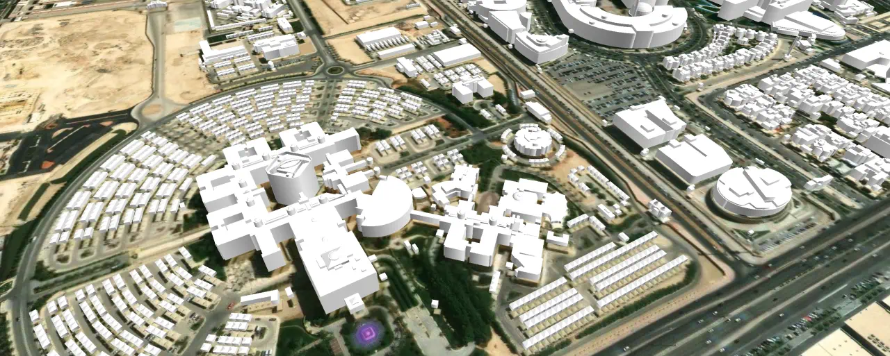
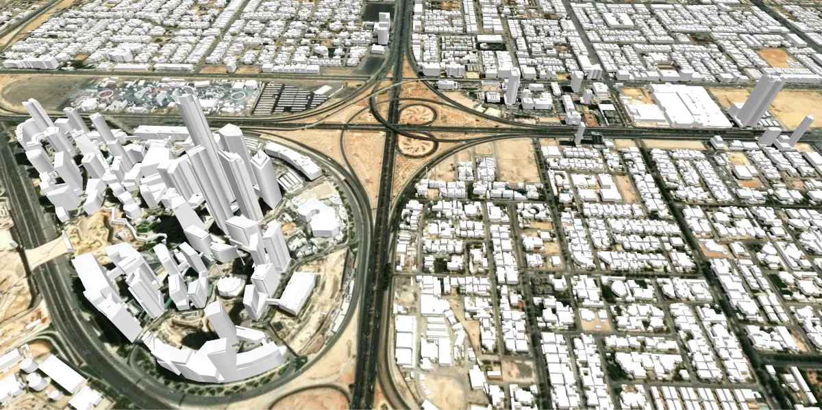
Our recently completed project to create a 3D model of Riyadh, Saudi Arabia, will be utilized by a real estate development company to enhance planning, development, and decision-making processes in the real estate sector. The 3D buildings, classified as LOD1.2 according to City GML standards, cover the entire city area within the administrative boundaries, about 2000 sq.km.
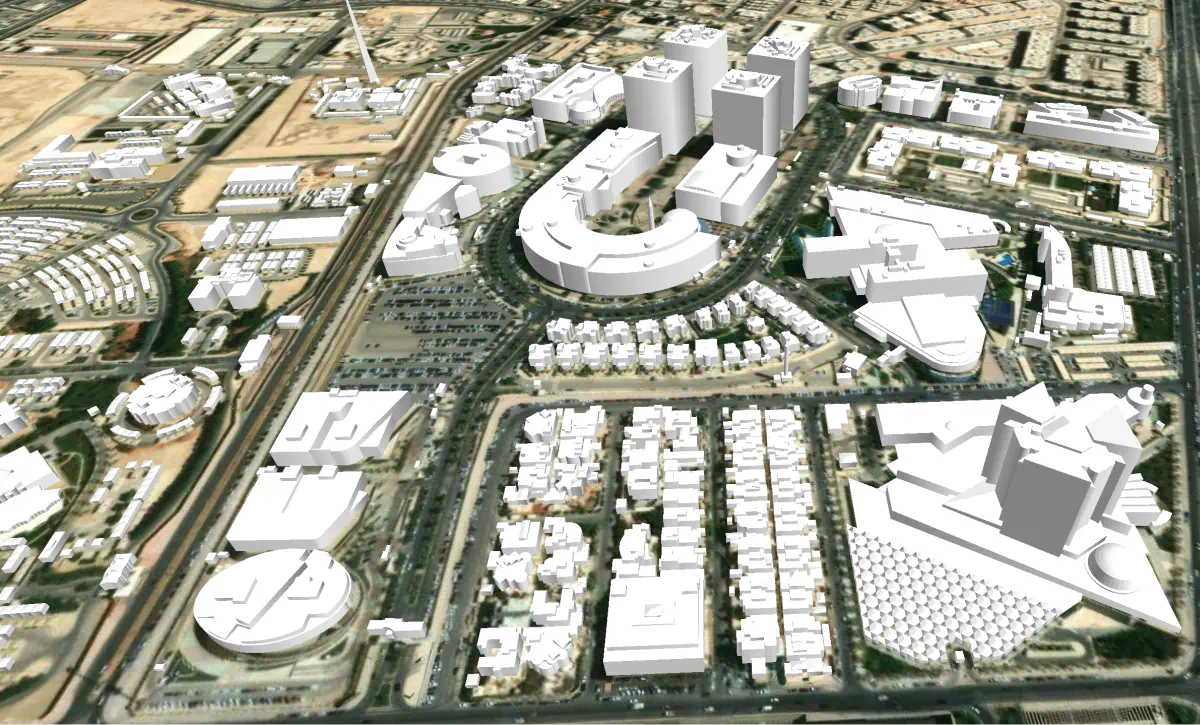
For buildings with complex architectural forms, such as palaces, business centers, and skyscrapers, more detailed models have been created as LOD2.1. Each building polygon contains additional attributes: building type, number of floors, plot area, and total built-up area. The 3D buildings are delivered in formats compatible with most 3D application tools such as Rhino, ArcGIS, and CAD.
This project demonstrates the potential of geospatial intelligence in shaping the cities of the future and highlights the value of strategic partnerships between technology providers and industry leaders.
More detailed information as well as free data samples can be provided on your request.

