Floods are becoming one of the most serious and costly risks for cities worldwide. With climate change and rapid urban growth, they are happening more often and hitting harder. For many communities, the question is no longer if flooding will happen, but how prepared they are.
And at the center of this preparedness is something surprisingly simple: accurate elevation data.
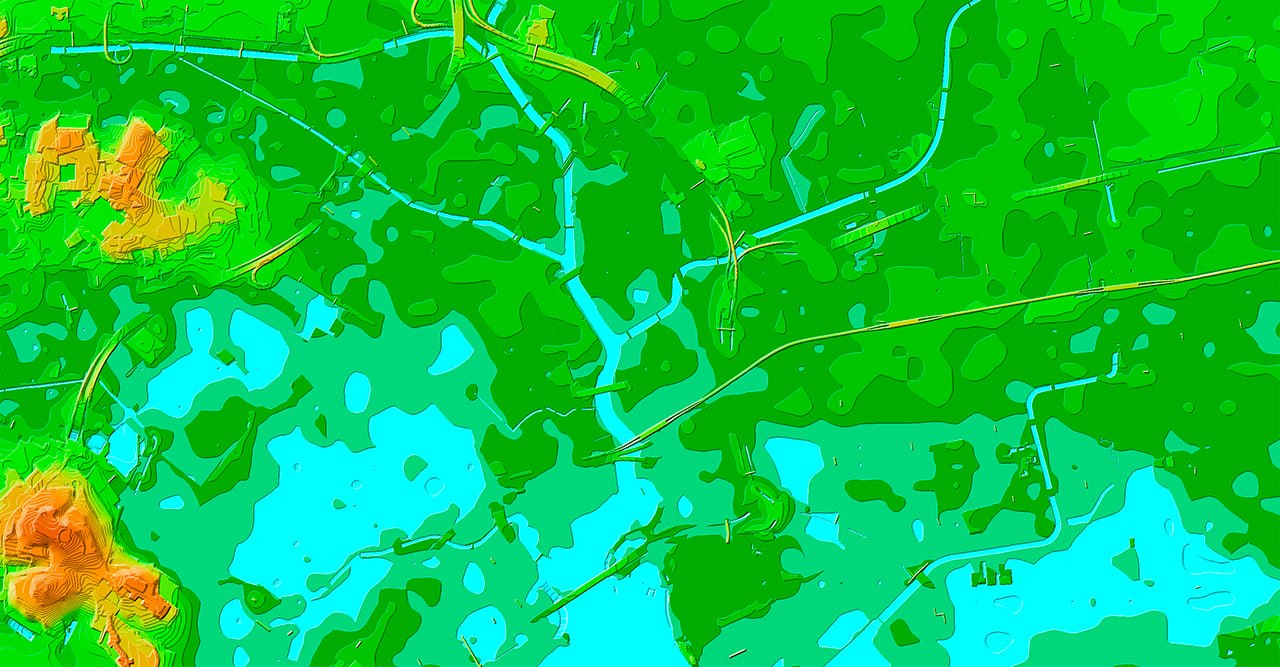
Elevation data — often represented as Digital Elevation Models (DEMs) — defines how water moves, where it accumulates, and which areas are at risk. Even a small inaccuracy can shift flood boundaries and impact thousands of buildings and infrastructure assets. That’s why elevation data is not just another map layer, but the foundation of reliable flood modeling.
But not all elevation data is equal. Low-resolution or outdated elevation models can lead to wrong conclusions — either underestimating risks or overestimating them. High-resolution data, especially in cities, makes a big difference. Small features like slopes, curbs, and buildings can completely change how water flows.
With accurate elevation data, engineers can spot problems early — before construction even begins. This helps avoid costly fixes later and makes infrastructure more resilient from the start.
Today, it’s not enough to understand risk at the city level. More and more decisions require analysis at the level of individual buildings or assets. It helps estimate how exposed a specific building is and what kind of damage might occur in a flood scenario.
This is especially important for:
- insurance and risk assessment
- investment decisions
- infrastructure management
In other words, elevation data is no longer just about maps — it’s directly linked to financial and operational decisions.
Flood Risk Mapping allows:
- Model realistic water flow and drainage patterns
- Identify areas where flood risk has changed
- Assess potential impacts on homes, businesses, and infrastructure
- Prioritize upgrades to levees, flood walls, culverts, and other protective systems
- Support land use and zoning decisions
- Estimate potential economic and social losses
Our approach
At VISICOM, we see this shift firsthand. More and more projects require not just elevation data on its own, but a complete geospatial model — including buildings, terrain, vegetation, and transport networks.
When these layers are combined, the results are much more reliable. It becomes easier to model real-world conditions, whether it’s flood risk, line-of-sight analysis, or infrastructure planning.
From our experience, the real value of elevation data comes from how well it works together with other data. When everything is aligned — terrain, buildings, land cover — you get a much clearer and more realistic picture of what’s actually happening on the ground.
As climate risks continue to grow, accurate elevation data is becoming essential — supporting better modeling, smarter infrastructure planning, and more informed decisions at every level.
For cities and communities that want to be resilient, investing in high-quality elevation data is no longer optional.

