All the members of Visicom friendly team congratulate our current and future customers with New 2020 Year and Christmas! Wish you all your business goals come true! Hope that 2020 holds success and good fortune in any endeavour you pursue.
Thank you for interacting with us, we are very thankful!;
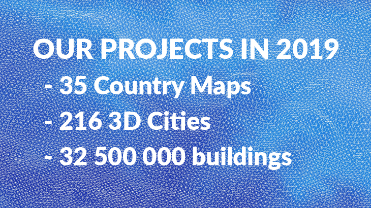
We would like to make a quick review about the projects we successfully accomplished in the passing year. Summarizing all the finalized works during the 2019 year, we can classify them as following:
- ✔ projects for 35 countries;
- ✔ regional models cover about 9590 thousand sq.km;
- ✔ 3D maps were produced for 25 countries and 216 cities and cover about 32.5 thousand sq.km;
- ✔ population maps were generated for 9 countries;
- ✔ vector maps as a component of GIS projects cover about 2500 thousand sq.km
The projects were different in designation, accuracy, scope and attributive data.
The cartographic materials, which initially were used for radio signal planning only, have been widely disseminated.
They were modified into a separate class of geodata, where the following subclasses or vertical markets can be distinctly allocated:
- ✔ telecommunication;
- ✔ smart cities and IOT;
- ✔ architecture;
- ✔ environmental management;
- ✔ retail and geo-marketing;
- ✔ transportation
Visicom continuously implements innovative technologies and methods of cartographic data processing, combining them with already recognized approaches. It allows us to expand the spectrum of geodata production constantly.
Explore the brochure with full list of our projects completed in 2019

