🌐 Empowering Singapore’s Digital Transformation
VISICOM continues to deliver actionable geospatial intelligence, empowering decision-makers with precise, high-resolution spatial data tailored to the unique and complex urban environment of Singapore.
As a global leader in smart city initiatives and digital twin technology, Singapore continues to set the benchmark for urban innovation.
The digital twin market in Singapore is estimated at USD 450 million in 2025, with projected growth to USD 1.95 billion by 2033.
This year, the government invested USD 5 billion in optimizing energy networks using AI technologies, laying the foundation for the next generation of smart city digital twins.
These strategic investments create a strong ecosystem for urban planning, telecommunications, and infrastructure development — making VISICOM’s high-resolution 3D model of Singapore a timely and highly relevant tool for forward-thinking organizations.
🛰️ High-Resolution 3D Model for a Complex Urban Landscape
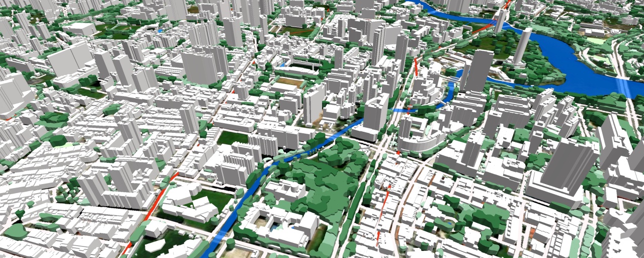
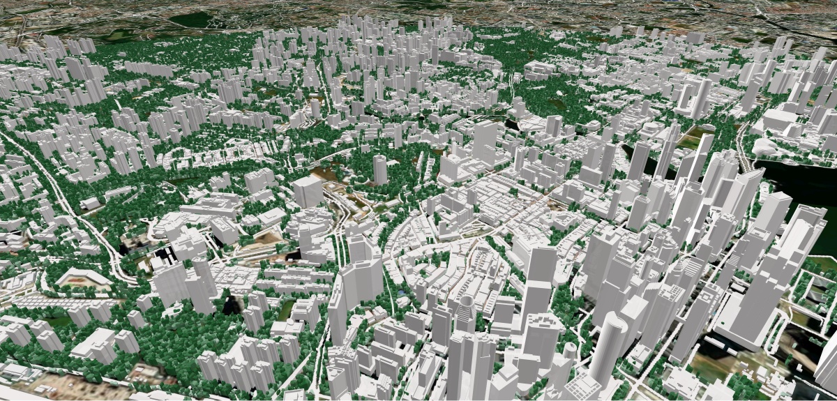
Our latest 3D model of Singapore was completed in 2025, covering the entire country and surrounding waters — more than 980 square kilometers — and available at 1 m, 2 m, and 5 m resolutions.
This dataset provides a highly detailed, accurate digital representation for a wide range of professional applications.
Singapore’s unique character as a dense, vertical city-state — with its mix of skyscrapers, residential zones, green spaces, and intricate infrastructure — is fully captured in VISICOM’s 3D model, offering an authentic view of both vertical and horizontal complexity.
🧭 Key Features of the Dataset
✅ Detailed 3D Building Models
Comprehensive representation of structures including roof shapes, heights, and individual building footprints, essential for accurate urban modeling in a high-density city.
🌳 3D Trees and Greenery
Modeled with separate canopy layers, accurately capturing parks, streetscapes, and urban vegetation.
🗺️ Comprehensive Elevation Models
Includes DTM (Digital Terrain Model), DSM (Digital Surface Model), and DHM (Digital Height Model) for precise analysis of terrain, buildings, and man-made structures.
🏗️ 25+ Clutter Classes
Extensive classification of urban and natural objects, supporting realistic modeling of Singapore’s diverse and complex landscape.
🚦 Detailed Transportation Network
Covers motorways, city streets, railways, bridges, overpasses, and tunnels, reflecting Singapore’s highly interconnected transport system.
📡 Optimized for Next-Generation Applications
Optimized for 5G mmWave network deployment, this dataset is fully compatible with all major RF-planning software platforms, enabling operators to plan next-generation networks with confidence.
Beyond telecommunications, VISICOM’s 3D model supports:
🏙️ Urban Planning
🏗️ Architecture & Construction
⚡ Infrastructure Development
🌿 Environmental Management
💬 Driving Innovation with Precision
By combining advanced geospatial technology with a commitment to data accuracy, VISICOM continues to empower cities and industries with spatial intelligence for a smarter, more sustainable future.

