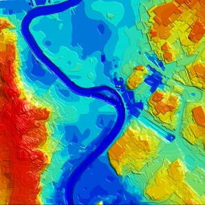
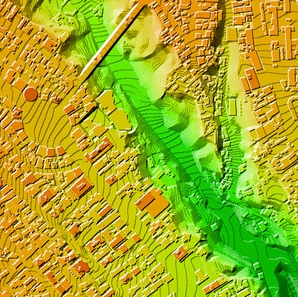
Digital Height Model (DHM)
Digital Height Model (DHM)
is a matrix of obstacles based on buildings, man-maid constructions and vegetation with the relative height attribute.
Usually, DHM is produced automatically or semi-automatically from stereo satellite images or LIDAR data and represents the distance between the ground and the tops of trees, buildings and other artificial objects.
Mostly DHM used for telecom projects and can be delivered in any RF-tool format like Planet, Atoll, ATDI etc.
We also support any GIS formats in case of DHM production for needs of range of environmental projects like flood modelling and more other.
We guarantee
Our manager and production teams are customer-oriented professionals highly skilled in RF planning process. Our production and sales infrastructure allows to realize the projects of various difficulty, complexity and scope supporting high-level data quality
Precise and up-to-date mapping information
Detailed and high-resolution terrain
Delivery in any RF planning tool and GIS format
Extra-accurate 3D buildings
Flexible price fitted to customer budget
Flexible price fitted to customer budget
Data formats
Alcatel A955
ICS Telecom
MapInfo
Pathloss
ASCII XYZ
ER Mapper Raster
Aircom Asset
NetPlan
Microstation
Mentum Ellipse
Raster images
ENVI Image Format
Atoll Forsk
AutoCAD
Neva
Mentum Planet
TIFF and GeoTIFF
Generic Binary
CelPlanner
ESRI ArcGIS
Odyssey
Nokia NetAct
ERDAS Imagine Image


Order product
Please, contact us directly if you have question
We always reply within 24 hours