3D CITY MODEL OF AUSTRALIA, 2020
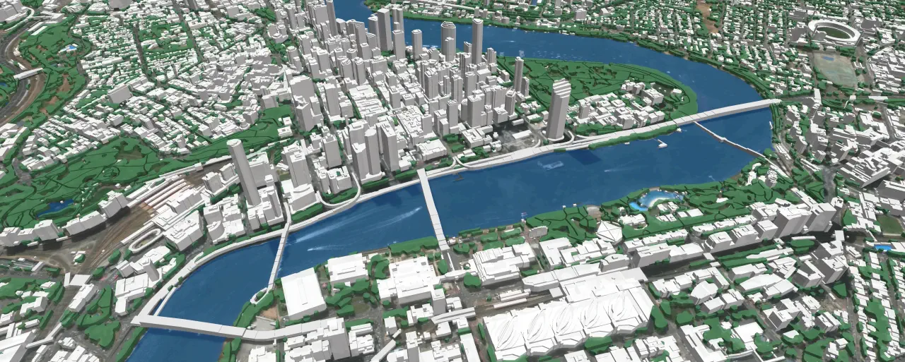
In urban areas with fewer propagation distances, dense and high-rise buildings, sometimes complicated relief, the accurate 3D geodata is an essential component of RF design: accurate simulation to support deployment, operation, and optimization of mobile networks.
We use recent vintage high-resolution stereo imagery to create 1 or 2 or 5 m geodata in LOD2 quality. 3D geodata accuracy – 2-3 m in x,y,z.
This project includes the following cities:
|
Type, City |
Area |
Model type |
|---|---|---|
| 3D map of Melbourne | 9 486 sq.km |
- Polygons with average heights - 3D Trees model with separate canopies heights - Recognition of vegetation types: winter or summer, tropical, subtropical |
| 3D map of Brisbane | 7 462 sq.km | |
| 3D map of Perth | 6 568 sq.km | |
| 3D map of Sydney | 5 176 sq.km | |
| 3D map of Adelaide | 3 541 sq.km | |
| 3D map of Canberra | 1 289 sq.km | |
| 3D map of Geelong | 711 sq.km | |
| 3D map of Gold Coast | 601 sq.km | |
| 3D map of Newcastle | 354 sq.km | |
| 3D map of Central Coast | 353 sq.km |
The total area of the 3D models of Australian cites covers more than 35000 sq.km.
Digital Surface Model (DSM), Digital Terrain Model (DTM) and Digital Elevation Model (DHM) were produced based on 3D terrain features which were derived from overlapping satellite imagery is taken from two different locations (stereo imagery).
Highly accurate building vectors with associated height values as attributes are captured through three-dimensional feature extraction in our photogrammetric software.
Clutter/Land Use/Land Cover describe the surface and built-up features which influence on radio wave propagation. They are classified into different classes: classes of built-up areas, water classes, classes of landscape and vegetation. An Urban Land Use map is produced from multispectral satellite imagery by the method of automatic classification with subsequent manual photo-interpretation and modification. 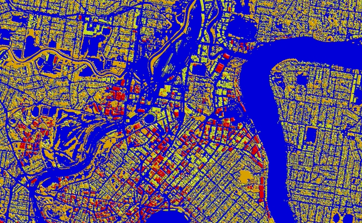
Download the free 3D data sample of Brisbane city model and booklet about project "3D RF map of Australian cities" to see more details.
Usually, outside the areas of 3D city coverage, operators still require geodata for RF planning and optimization in suburbs. We propose 2D Urban Model, 2.5D Urban Models, 2D Regional Models with clutter height with 5, 10, 20 m resolution, with DTM, clutter (land use) and vector layers.

