3D Geodata for 5G Planning Of South Korea
If you need to plan the 5G network, we have the best solution.
Visicom will be able to help you with this objective.
3D South Korea project is the latest achievement for our geodata portfolio.
Please explore samples of South Korea
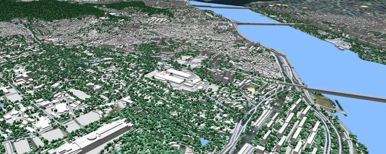
- The 3D city models covering 1064 SQ.KM area of 13 cities across 4 provinces.
- Budget 3D solution for suburbs and rural areas.
- 3D geodata accuracy - 3-5 m in X,Y,Z.
- 3D Vegetation and Bridges.
- The free data sample of 3D map tailored for 5G planning.
South Korea 3D Geodata contains highly accurate 3D Buildings with roof details, Clutter/Land Use/Land Cover Model, Vector model, Digital Terrain Model (DTM), Digital Surface Model (DSM), Obstacles Heights (Clutter Heights) Model.
Visicom focusing on the telecom market for more than 18 years, that’s why you can be sure of the quality of our product.
Our digital mapping solutions are widely used for world global companies.
Download the brochure and [free data sample of 3D map tailored for 5G planning][3] for more details.
Our geodata catalogue includes over 5000 cities across 120+ countries.

