In today's increasingly connected world, access to reliable internet is no longer a luxury — it's a necessity. According to official research by “Statista” there are 5.45 billion internet users worldwide, which amounted to 67.1 percent of the global population (based on article https://www.statista.com/statistics/617136/digital-population-worldwide/ July 2024). However, millions of people living in rural and underserved areas around the world still face insufficient or non-existent internet coverage. This digital divide not only limits their access to information and services but also hinders economic growth, education, and social integration. Bridging this gap is a critical challenge, and 3D radioplanning is emerging as a powerful tool to extend network coverage in these remote areas.
Where in the world is the worst internet connection?
In reality, poor internet connectivity can be found in any country. It may depend on factors such as geography, population density, and, most importantly, the investment of mobile operators and internet providers in infrastructure.
Typically, internet infrastructure is well-developed in cities and suburbs where high population density justifies the cost of deploying advanced technologies like fiber-optic networks. However, the situation can be quite different in remote or rural areas. Here are some of the most common reasons:
- Geographical Barriers: Remote villages are often located in areas with challenging terrain, such as mountains, forests, or large open spaces, which can complicate the deployment of physical infrastructure, such as cables and towers. For example, part of the Bavarian Alps in Germany may face connectivity issues due to the difficulty of laying fiber-optic cables in mountainous regions.
- Low Population Density: In sparsely populated areas, the cost of installing and maintaining high-speed internet infrastructure per user is significantly higher. This economic factor means that telecommunications companies may prefer urban areas where the return on investment is higher.
- Aging Infrastructure: Some remote areas may still rely on outdated infrastructure, such as copper telephone lines, which cannot support modern high-speed internet. Upgrading these networks requires significant investment.
3D Radio Planning
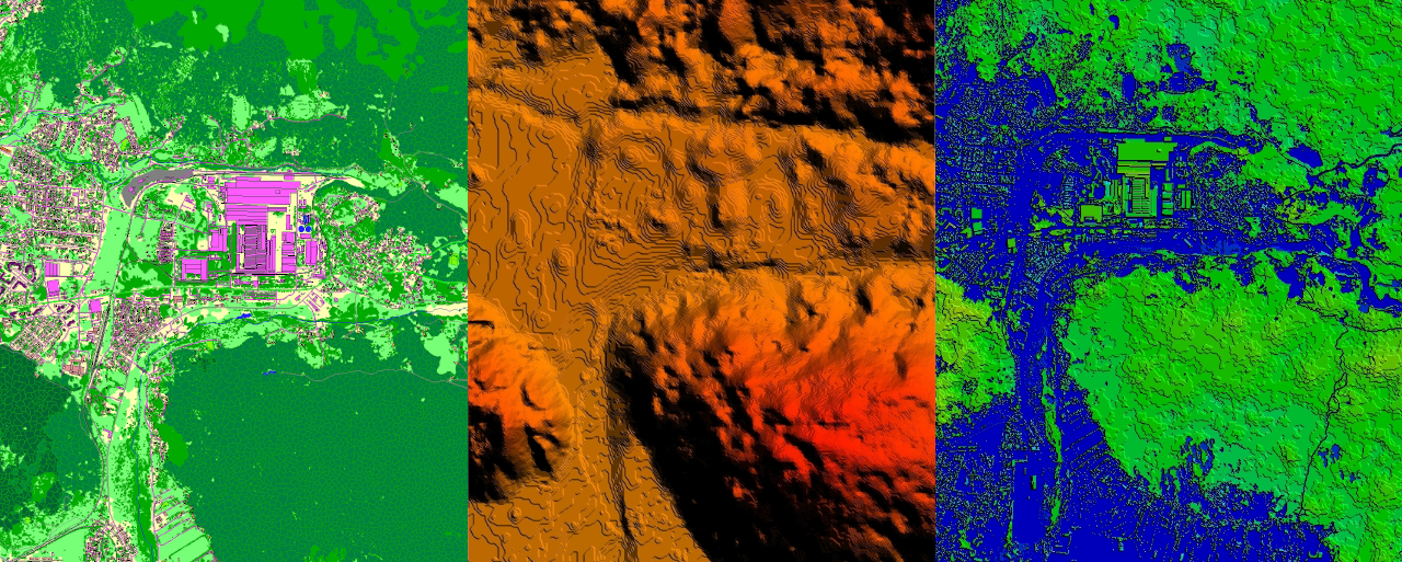
3D radio planning is a technology that uses detailed three-dimensional geospatial data to create accurate models of the environment in which a network will operate. By considering the height, shape, and materials of buildings, vegetation, and terrain features, 3D data allows network planners to predict signal behavior under real-world conditions, determine the optimal placement of antennas, towers, and other infrastructure elements, ensuring maximum coverage and signal strength while minimizing interference. In rural areas, where the landscape can be a significant barrier to connectivity, 3D radio planning is especially valuable.
Extending Coverage to Rural Areas
One of the main advantages of 3D radioplanning is its ability to simulate and optimize coverage in complex terrains. In rural areas, where mountains, forests, and other natural features can block or reflect signals, traditional planning methods often prove insufficient. However, 3D radio planning can model these obstacles and suggest the best locations for infrastructure, such as placing towers on elevated terrain or using directional antennas to bypass obstructions.
Additionally, 3D radio planning can assist in designing small cellular networks—smaller base stations with lower power—that can be deployed in rural areas to provide local coverage. By accurately modeling the surrounding environment, planners can determine the most effective placement of these small cells to fill coverage gaps and enhance network reliability.
Economic Efficiency and Sustainability
Building network infrastructure in rural areas is often an expensive endeavor, but 3D radio planning can help reduce these costs. By providing accurate environmental models, this technology allows network operators to optimize their investment, ensuring that each piece of infrastructure provides the maximum possible coverage with minimal redundancy. This not only reduces initial capital expenditures but also lowers ongoing maintenance costs.
Furthermore, 3D radio planning contributes to environmental sustainability. By optimizing the placement of infrastructure, it minimizes unnecessary construction and reduces the ecological impact of network expansion. This is particularly important in rural areas, where preserving natural landscapes is often a priority.
Bridging the Digital Divide
Expanding connectivity in rural areas is more than just providing internet access; it's about empowering communities. With reliable internet, rural populations can access online education, telemedicine services, e-commerce opportunities, and social connections that were previously unavailable.
3D radio planning is a crucial tool for turning this vision into reality. By overcoming the challenges of rural areas and optimizing network deployment, it plays a key role in bridging the digital divide. The more regions adopt this technology, the closer we get to a world where everyone, regardless of location, has the opportunity to communicate, learn, and grow.
As the world continues to move towards greater digital integration, the importance of tools like 3D radio planning cannot be overstated. It's not just about expanding network coverage – it's about building a more inclusive and connected world for all.
The data produced by Visicom is the foundation of the planning process in any country.
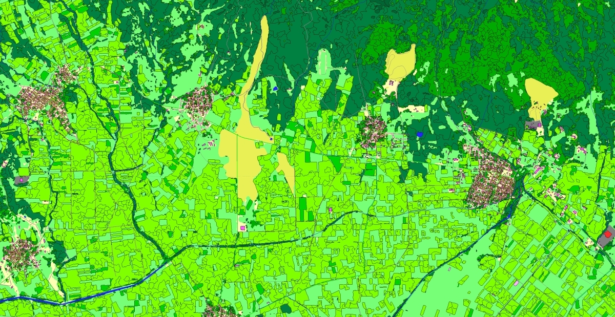
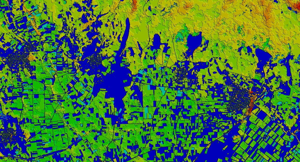
The usage of 3D maps offers a number of advantages for planning processes in any industry on a national scale. 3D data creates a comprehensive digital representation of the country, incorporating various geodata layers in maps for regional planning, including:
- Street and road networks
- Railways
- 3D bridges
- Terrain relief
- Hydrography
- Land use
- Population density distribution
Over the past few years, we have created 3D coverage for 17 countries using a machine learning (ML) algorithm, encompassing approximately 150 million buildings.
3D models are currently available for the following countries: UAE, Qatar, Kuwait, Bahrain, Turkey, Croatia, Montenegro, Romania, the Czech Republic, Greece, Slovakia, Mexico, Taiwan, Austria, North Macedonia, Vietnam, and Thailand.

