Our recent telecom project for Malaysia focused on developing digital maps for 5G network planning nationwide. This included a comprehensive 2D map covering the entire country, spanning 330,000 square kilometers with a resolution of 10 meters.
The 2D Regional model contains a Digital Terrain Model (DTM), Clutter Model, and Vector Data created based on Sentinel satellite imagery processing and 5m imagery for urbanized areas, relevant as of 2023.
The Clutter Model 10 m resolution was created using machine learning technology to recognize satellite images, providing a detailed and accurate classification of land use and building types.
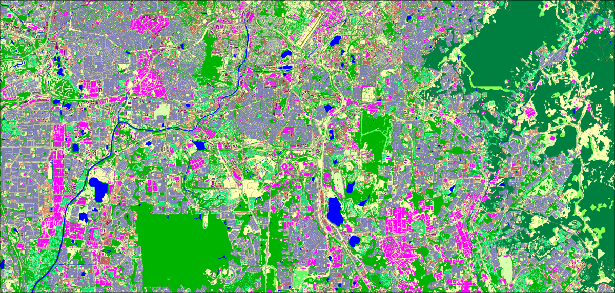
The Vector Map layers also include:
- New administrative boundaries: 4 levels for West Malaysia, 5 levels for East Malaysia
- Population distribution map based on 2020 census data and official population projection for 2023
The administrative boundaries of both West Malaysia (WM) and East Malaysia (EM) were carefully defined and mapped to census data, providing a comprehensive basis for demographic analysis and regional planning. In West Malaysia, the administrative division is structured into four levels with 1,780 objects. In East Malaysia, the administrative division is organized into five levels with 115 objects.
Night Population Map Malaysia (static model) provides an overview of population density in residential areas. Two input layers are used to calculate the matrix of the population distribution model: a clutter model and experimentally derived coefficients that distribute the proportions of population density for different classes. The calculations are based on the type of building class, the percentage of built-up area of blocks within each cell, and individually calculated population density coefficients for each administrative unit.
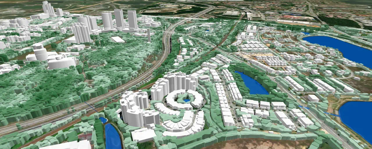
We also offer delivery of 3D maps of any city in Malaysia with a resolution of 1m, 2m, or 5m.
3D models designed for 5G network planning take into account all the features of mm-wave propagation:
- Provide all building structures, including roof elements
- Allow for complex architectural structures and irregular dense development
- Include vegetation models with individual tree heights
As a budget solution for suburban territories and densely populated areas, 2.5D maps can be produced, combining low cost with the retention of a sufficient level of accuracy.
All our map products for Malaysia are compatible with any planning tool and distribution models - Atoll, Planet, Asset, and others.
You can order an example of 2D/2.5D/3D models for testing here
Through the implementation of the latest machine learning technologies and the use of Convolutional Neural Networks (CNN), our geodata support companies around the world by helping them conduct geospatial analysis based on high-quality maps.
Our 2D/2.5D/3D models, tailored for each specific project, provide accurate geometry and heights of buildings and vegetation, up-to-date terrain, and landscape features for any terrain.

