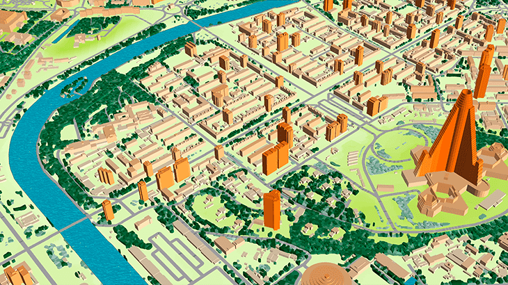
3D MODEL OF PYONGYANG
This mapping product covers 700 sq. km of Pyongyang 3D city model (Capital of North Korea).
The delivered data has been converted into the ESRI GRID / SHP format.
3D geodata accuracy – 2 m in X,Y,Z.
The delivered package includes:
✅ [Digital Terrain Model][1]
✅ [Digital Surface Model][2]
✅ Land Use Map
✅ [Building Heights Model][3]
✅ Vector Data
✅ Text labels
✅ Orthoimage
We understand the precise geodata requirements to design next-generation networks in mmWave frequencies range. Based on our 19-years experience we offer the most cost-effective solution for any territory fitted to your budget. Please visit our webpage "Pilot Projects for 5G Planning over the World".
Download the **free data sample of Pyongyang digital model** in order to explore more details
**Send us your request for more information**
[1]: https://visicomdata.com/products/elevation_products/digital_terrain_model_dtm
[2]: https://visicomdata.com/products/elevation_products/digital_surface_model_dsm
[3]: https://visicomdata.com/products/elevation_products/digital_height_model_dhm
[4]:

