Digital Maps For Telecom (RF Map)
We focus on the production of Digital Mapping Products for the wireless telecommunication industry. Starting with the implementation of the 2G networks and further deployment 3G, 4G and 5G ones we support our customers by providing them with highly accurate geospatial data.
Tailored for the needs of the telecom market, our geodata products enable you to achieve accurate results along with network planning and optimization.
Our long-time relationships with planning tools vendors and the biggest players of the telecom market allow us to meet our customer’s requirements whenever they operate.
We have a rapidly growing archive of OFF_THE_SHELF data delivered immediately for urgent project implementation.
Delivered geodata:
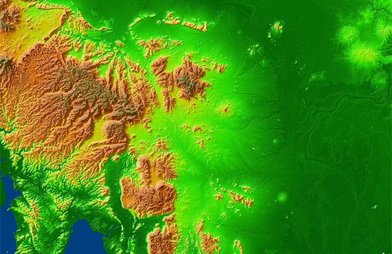
- Digital Terrain Mode
- Digital Surface Model
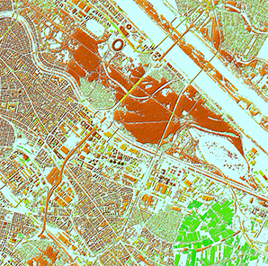
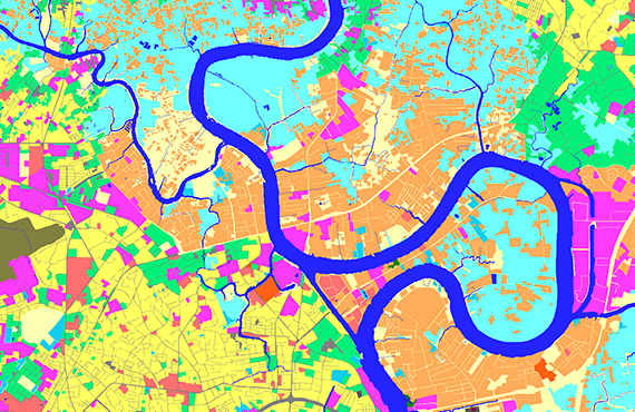
- Clutter/Land Use Model
- Linear objects
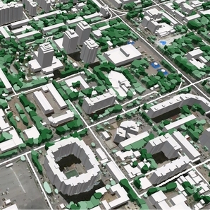
- Buildings 3D Model
- 3D Trees Model
- 3D Engineering constructions Model
- Orthoimagery
- Population Distribution Model
We guarantee
Our manager and production teams are customer-oriented professionals highly skilled in RF planning process. Our production and sales infrastructure allows to realize the projects of various difficulty, complexity and scope supporting high-level data quality
Precise and up-to-date mapping information
Detailed and high-resolution terrain
Delivery in any RF planning tool and GIS format
Extra-accurate 3D buildings
Flexible price fitted to customer budget
Flexible price fitted to customer budget
Data formats
Alcatel A955
ICS Telecom
MapInfo
Pathloss
ASCII XYZ
ER Mapper Raster
Aircom Asset
NetPlan
Microstation
Mentum Ellipse
Raster images
ENVI Image Format
Atoll Forsk
AutoCAD
Neva
Mentum Planet
TIFF and GeoTIFF
Generic Binary
CelPlanner
ESRI ArcGIS
Odyssey
Nokia NetAct
ERDAS Imagine Image


Order product
Please, contact us directly if you have question
We always reply within 24 hours