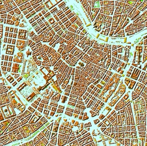
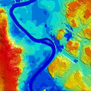
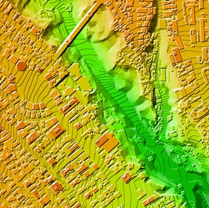
Elevation Data
Elevation data — substantial mapping layer to perform effective geospatial analyses like for:
- Telecommunication Networks Planning
- Natural Resource Mapping
- Natural Disaster Prediction
- Roads networks planning
- Urban management
- Solar Resource Assessments
We produce 3 types of Digital Elevation Model (DEM) for any territory over the world according to the customer’s project requirements:
▪ Digital Terrain Model (DTM) ▪ Digital Surface Model (DSM) ▪ Digital Heights Model (DHM)
DTM, DSM and DHM can be used singly or in different combinations to meet customer’s needs and requirements.
We guarantee
Our manager and production teams are customer-oriented professionals highly skilled in RF planning process. Our production and sales infrastructure allows to realize the projects of various difficulty, complexity and scope supporting high-level data quality
Precise and up-to-date mapping information
Detailed and high-resolution terrain
Delivery in any RF planning tool and GIS format
Extra-accurate 3D buildings
Flexible price fitted to customer budget
Flexible price fitted to customer budget
Data formats
Alcatel A955
ICS Telecom
MapInfo
Pathloss
ASCII XYZ
ER Mapper Raster
Aircom Asset
NetPlan
Microstation
Mentum Ellipse
Raster images
ENVI Image Format
Atoll Forsk
AutoCAD
Neva
Mentum Planet
TIFF and GeoTIFF
Generic Binary
CelPlanner
ESRI ArcGIS
Odyssey
Nokia NetAct
ERDAS Imagine Image


Order product
Please, contact us directly if you have question
We always reply within 24 hours