LoD 2 + 3D trees
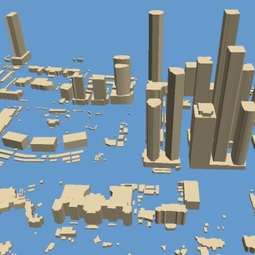
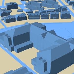
Roof shapes are the most significant improvement for LoD 2 buildings compared to LoD 1. Data represent 3D building shapes, including complex architectural forms: sloping roofs, roof furniture, elevator shafts, towers, and spires.
LoDs 2.0 and 2.1 building models are produced for various tasks of environmental management like solar energy assessment, GIS and architecture projects, 3D visualization of cities, and developed in multiple GIS formats (Rhino, ArcGIS, Autocad dwg, Sketchup skp, fbx, obj etc.). The parameters of azimuth, tilt angle, area of flat parts, and roof height can be calculated and assigned for each roof element.
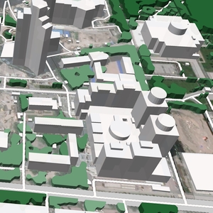
As a rule, a contemporary city involves many parks, squares, recreation areas, tree plantations, etc. In some cities, the buildings are entirely shrouded in foliage. 3D Tree models ensure an accurate and reliable 5G network planning process, allowing placing a required number of base stations for stable signal and full coverage.
We produce high-level accuracy 3D vegetation data as separated canopies, each with a unique height and size of crown outlines.
We guarantee
Our manager and production teams are customer-oriented professionals highly skilled in RF planning process. Our production and sales infrastructure allows to realize the projects of various difficulty, complexity and scope supporting high-level data quality
Precise and up-to-date mapping information
Detailed and high-resolution terrain
Delivery in any RF planning tool and GIS format
Extra-accurate 3D buildings
Flexible price fitted to customer budget
Flexible price fitted to customer budget
Data formats
Alcatel A955
ICS Telecom
MapInfo
Pathloss
ASCII XYZ
ER Mapper Raster
Aircom Asset
NetPlan
Microstation
Mentum Ellipse
Raster images
ENVI Image Format
Atoll Forsk
AutoCAD
Neva
Mentum Planet
TIFF and GeoTIFF
Generic Binary
CelPlanner
ESRI ArcGIS
Odyssey
Nokia NetAct
ERDAS Imagine Image
Order product
Please, contact us directly if you have question
We always reply within 24 hours


