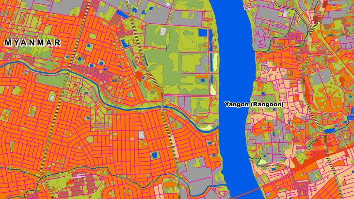
2D Regional Model of Myanmar
2D Regional model is a medium-to-low-resolution database designed for large-area RF planning. It's the ideal solution for initial network planning and geodata for network planning in rural areas.
2D Regional RF map of Myanmar covers, 676578 km2. We have used recent vintage imagery Sentinel of 10 m resolution to create 20 m resolution geodata. SRTM/ASTER DEM data and available topomaps were processed for DTM/DSM production. Clutter/Land Use/Land Cover are classified into different classes: classes of built-up areas, water classes, classes of landscape and vegetation. Land Use map was produced from multispectral satellite imagery by the method of automatic classification with subsequent manual photo-interpretation and modification.
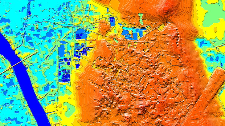
2D Regional model allows quickly visualize terrain and clutter over large areas or entire countries. It consists of the following integrated layers: digital terrain model (DTM), clutter, linear vectors, orthoimage.
Data can be delivered in all major RF planning formats, Regional Models may be integrated with 2D Urban ones to improve their accuracy in urban and suburban areas.
Download the booklet about the project "RF map of Myanmar" and free data sample to see more details.
See also Myanmas 3D Model for RF planning and GIS project:
- 3D Yangon model - 3D Mandalay model

