Land cover data provides essential insights that enable effective environmental management. By understanding how land is used and how its surface characteristics change, it becomes possible to implement strategies that protect ecosystems and promote sustainable development.
Here are the top four ways land use data supports environmental management:
1. Utilizing impervious surface data for stormwater management and flood risk prediction
Impervious surfaces—such as roads, parking lots, and rooftops—prevent rainwater from naturally infiltrating the soil. This can lead to increased surface runoff and higher flood risks in urban areas. By accurately mapping these surfaces, planners can better understand stormwater flow patterns and design more effective drainage systems. This data is essential for predicting flood-prone zones, minimizing infrastructure damage, and protecting communities from flood hazards.
2. Assessing the impact of the urban heat island effect and green space accessibility
Urban heat islands occur when built-up areas absorb and retain heat, causing temperatures to rise compared to surrounding rural areas. Tree canopy data helps identify neighborhoods lacking vegetation. By analyzing green coverage, urban planners can prioritize tree planting and the creation of green spaces that cool the air and improve its quality.
3. Improving water resource management
Water resource management heavily relies on the analysis of vegetation, soil types, and land use, all of which influence water quality and availability. Monitoring these factors enables the identification of pollution sources, effective watershed management, and the implementation of water conservation measures to support agriculture, industry, and communities.
4. Monitoring landscape transformations over time
Land use and vegetation information play a fundamental role in environmental management. Comparing datasets across different time periods reveals significant changes, such as deforestation and urban expansion. This temporal analysis helps environmental organizations monitor ecosystem health, identify critical areas that need protection or restoration, and study the impacts of climate change.
What data does Visicom offer to solve these tasks?
-
- Clutter model for land use classification
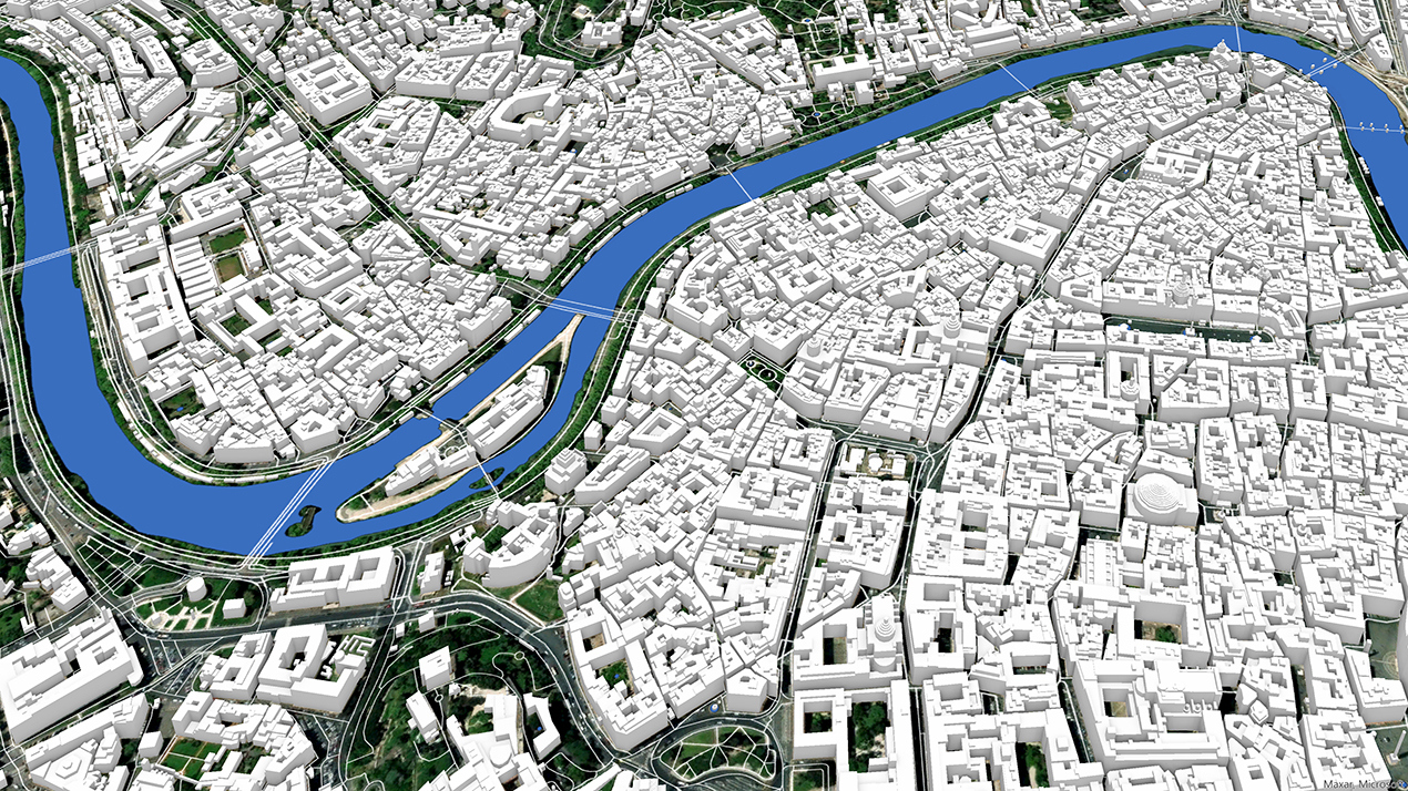
- Network of roads, railways, bridges, and streets with names and surface types
- 3D building models with roof type classification
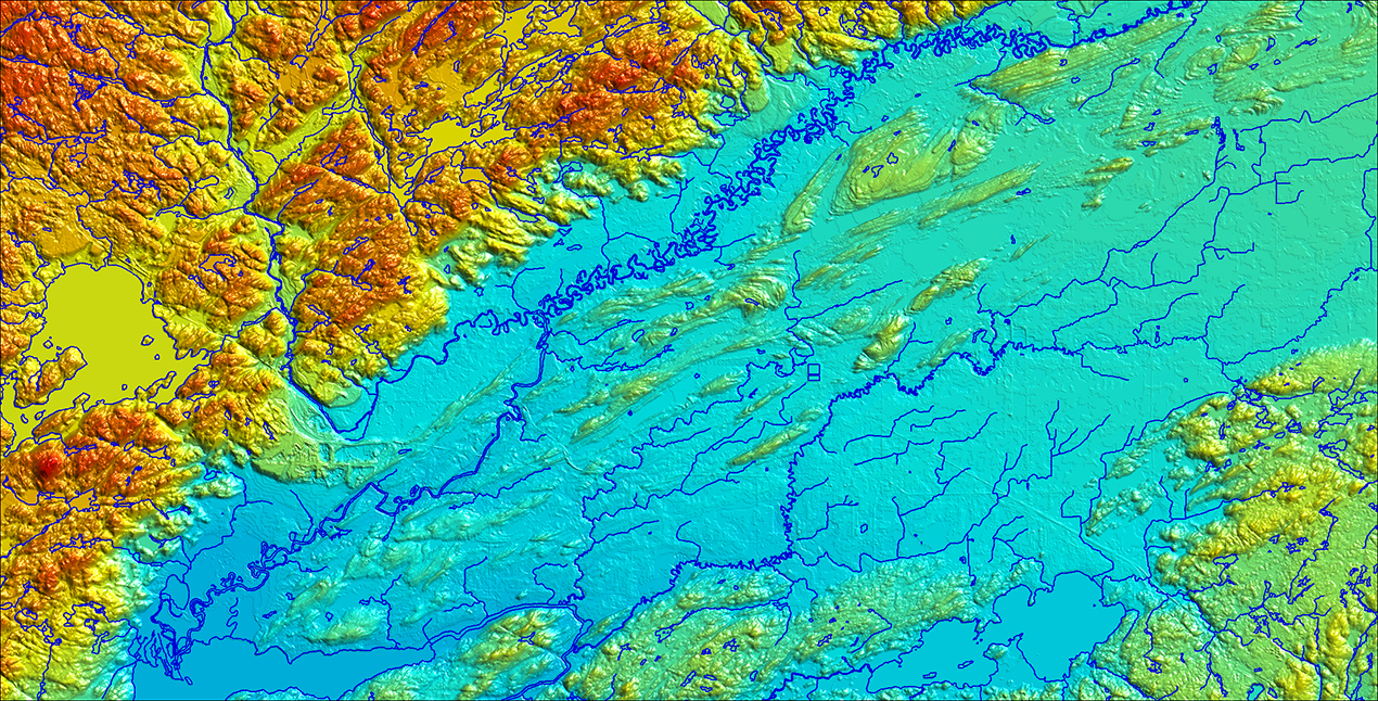
- Network of water bodies, including oceans, seas, bays, estuaries, lakes, rivers, streams, reservoirs, springs, waterfalls, rapids, and more, with names, surface area, and coastline length
- 3D vegetation model with detail down to the canopy of each individual tree
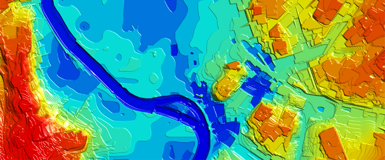
- Digital Terrain Models (DTM)
- Digital Surface Models (DSM)
We understand the importance of accurate and up-to-date land use data for the sustainable development of territories. Our team delivers high-quality geodata and mapping solutions that help clients worldwide address environmental and infrastructure challenges effectively. From flood modeling to landscape change analysis—we support data-driven decisions aimed at environmental preservation and smart planning.
If you are looking for a reliable partner in spatial and natural resource management, feel free to contact us at [email protected]. We’ll be happy to assist you with your request.

